The Met Office has issued two snow and ice amber warnings, with disruption to travel and power cuts expected across the UK.
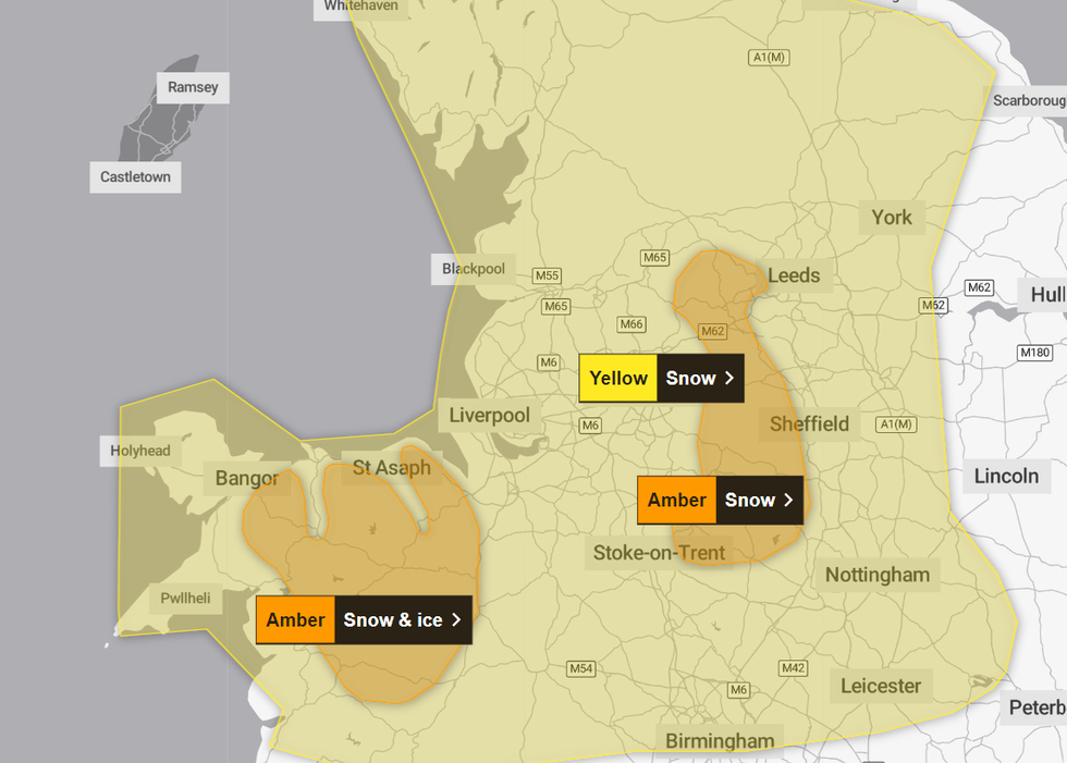
The first warning for snow and ice covers Wales and northwest Shropshire, whilst the other the Peak District and south Pennines and is just for snow.
Both warnings are in place for Thursday. The alert in Wales begins at 8.00am and ends at 3.00pm, while the one for the Peak District starts at 12.00pm and continues until 6.00pm.
The weather office has cautioned that due to the wintery conditions, there is a “good chance that some rural communities could be temporarily be cut off”.

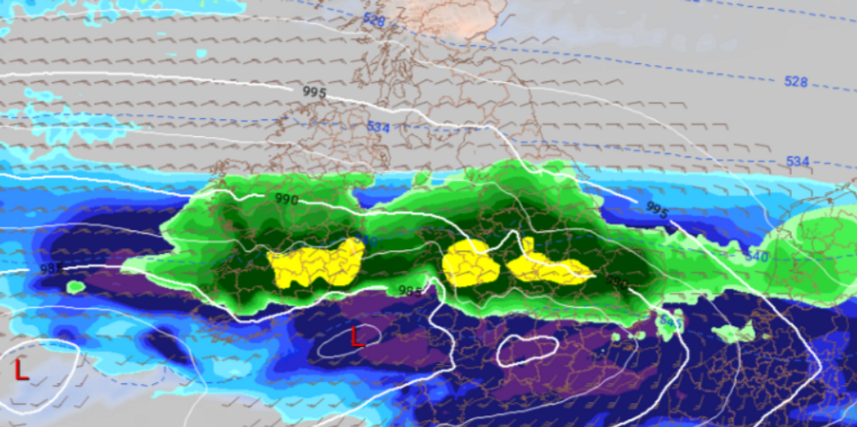
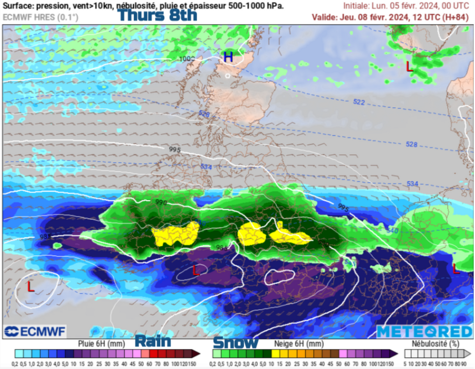
The snow map shows a bout of snow hitting Wales and the Peak District tomorrow
Netweather
They said that travel delays are to be expected, both on roads and by rail. The snow could lead to some vehicles and passengers being stranded, whilst rail services could be heavily impacted.
Power cuts are also possible, the weather office has cautioned, stating that mobile phone coverage could be affected.
The Met Office also said that icy pavements and cycle paths could likely lead to injuries.
They said: “Snow is expected to develop during Thursday morning and become persistent and at times heavy before slowly easing later in the day. As milder air begins to arrive from the south, there is a chance that snow could turn to freezing rain across some higher routes above 200 metres.
WEATHER LATEST:

The Met Office has issued two new rare amber alerts for snow and ice
Met Office
“Across the warning area, 10-15 cm of snow is expected quite widely but some places, particularly those above 200 metres, may see 20-25 cm of snow. Strong and gusty easterly winds may lead to some drifting in places.”
Driving in these conditions has been cautioned against, and the forecaster has advised people to use public transport if they need to make a journey.
An amber warning is the second most serious alert issued by the Met Office – with yellow being the least serious and red being the most.
The two new alerts join three yellow warnings, all for snow and ice.

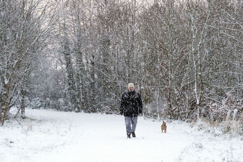
The Met Office said that icy pavements and cycle paths could likely lead to injuries
PA
The three alerts cover parts of Northern Ireland, Scotland, Wales and England, with the first beginning at 4.00pm today and the final ending at 6.00am on Friday.
Met Office Deputy Chief Meteorologist Chris Almond said: “There’s an increased signal for wintry hazards as we move through the week as cold air from the north moves over the UK.
“It’s from Thursday that the snow risk becomes potentially impactful, as mild air attempts to move back in from the south, bumping into the cold air and increasing the chance of snow where the two systems meet.
“While there are still lots of details to work out, the initial snow risk looks highest in northern England and Wales from Thursday. 1-2cm is possible to low levels, with 10-20cm possible over the highest ground within the warning area. This snow is likely gradually change to sleet and rain later on from the south.”






Post comments (0)