A shapeshifting pressure dome powered by the jet stream will juggle Britain’s weather between storms and tropical warmth.
Temperatures this weekend will plummet before rocketing through the end of March ahead of a two-week blast of sunshine.
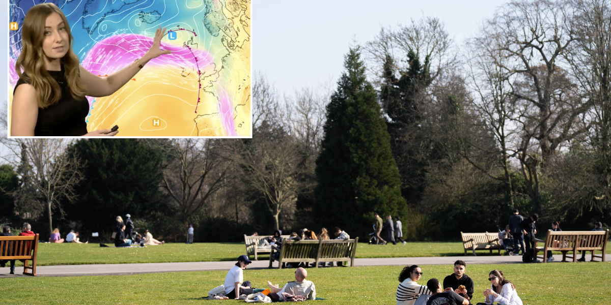
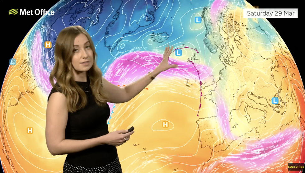
The UK has become the battleground for stormy low pressure targeting Scotland and the north, and ‘anticyclonic’ high pressure to the south.
High pressure during spring largely drives warm sunshine, particularly if it sweeps up in a dome from the southern tropical Azores.

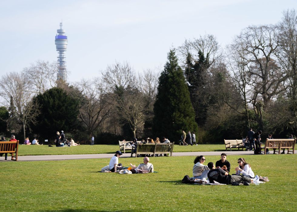
Britain is set to see two weeks of sunshine
PA
Through the next few days, however, it moves south to north, then eastwards, and then to the northeast, stretching and shrinking as the weather yo-yos.
Met Office meteorologist Honor Criswick said: “As we head into the first week of April, there are signals for high pressure dominating, but there is a chance it could be to the north or perhaps more to the south with an Azores high extension across the UK.
“That does have big impact on the kind of weather we can expect and the kind of temperatures, and it is likely we see some warm sunny spells as that high pressure begins to dominate more and more.
“Towards the end of the week, it is likely that high pressure will shift slightly, moving further north-eastwards, and with this is temperatures will still be widely above average, but it is likely that the driest conditions will be slightly more to the west.”
Storms to the north of the country threaten a wet and windy weekend with hilly regions at risk of late-season snow.
The weather will take a chillier turn through Saturday as a cold front sweeps in from the Atlantic.
LATEST DEVELOPMENTS:

Honor Criswick warns the jet stream will strengthen a low-pressure storm
MET OFFICE
Criswick said: “A cold front might linger for a time across parts of East Anglia, Sussex and Kent, and elsewhere showers are moving in from the west.
“With that colder air, some of these showers could bring a little bit of snow, especially across western parts of Scotland, but mainly across hilly areas.
“There will be some quite heavy showers at times, and perhaps hail and the odd rumble of thunder, particularly around the coasts of Scotland, and it is still going to be fairly bluster, so it is not going to be particularly pleasant.”
Longer-range outlooks paint a warmer, sunnier picture through the run up to mid-spring.
Above-average temperatures are more likely than below through the end of March and the first fortnight of April.

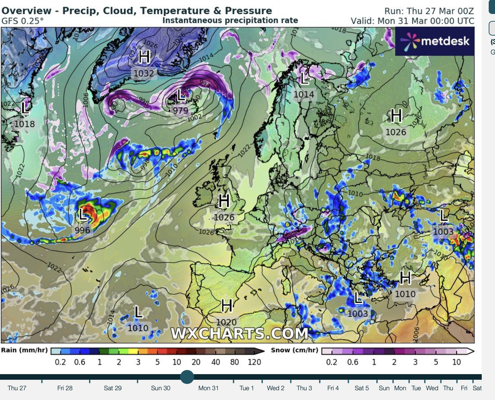
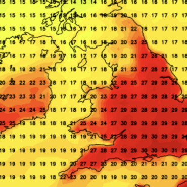
High pressure dominates
WXCHARTS
Warm North-Seas-surface temperatures could hasten the arrival of spring with summer warmth hastened under high pressure.
The long-range picture is also drier than average with forecasts of dry warmth instead of April showers.
Jim Dale, meteorologist for British Weather Services and social commentator, said: “We have high pressure looking like it is more dominant than low pressure, and this will continue the theme, for much of the country, of dry weather through April.
“This means little chance of April showers through the month.
“Through the next few days, there are signs of the Azores High drifting closer to the UK, and that means more of a chance of warmer and drier weather.”


Post comments (0)