‘Tropical moisture’ pouring into heat-stricken America will trigger a 75mph ‘monsoon-like’ deluge.
A 100F heat plume from the Gulf of Mexico threatens torrential downpours, hailstorms, storm-force winds and flash flooding.
Tropical heat hitting a cold front will feed ‘extreme instability’ putting swathes of the United States on alert for dangerous weather.
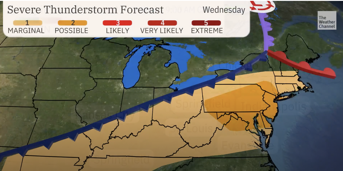
Weather Channel meteorologist Briana Waxman said: “Moisture will surge northwards ahead of a cold front tracking from the Midwest into the northeast.
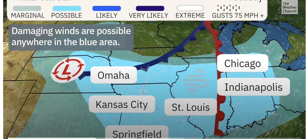
“This moisture will help to fuel the threat of severe storms, and damaging winds will be possible across the entire area.
“Locally, heavy rainfall could cause dangerous flash flooding, and so the Wednesday morning commute could be a bit hairy if storms are still rolling through the area.
“On Wednesday afternoon and evening, the threat shifts to the northeast with the risk of damaging winds and even a few brief tornadoes possible.”
 US weather: Southern 100F heat plume to trigger 75mph ‘monsoon-like’ delugeThe Weather Channel
Most at risk over the coming days is the Four Corners region – Colorado, Utah, Arizona and New Mexico.
Temperatures in the low- to mid-100Fs will fuel the assault as storms sweep through the Mississippi Valley into Tennessee and Ohio, according to the National Weather Service (NOAA).
It has a raft of advisories in force for excessive heat and floods triggered by an ‘influx of tropical moisture’.
A spokesman said: “Daily shower and thunderstorm chances continue over portions of the Southwest, Four Corners Region as an influx of tropical moisture brings monsoon-like conditions.
“By Wednesday, rainfall may be particularly concerning over portions of New Mexico that are sensitive to additional rainfall.
“Damaging winds, large hail, and a tornado or two may occur.”
US LATEST:

Wind threat to affect Colorado, Utah, Arizona and New Mexico
The Weather Channel
Storms will be driven by a ‘collision of air masses’, thrusting 100F-plus heat against cooler air from the west.
A large storm system will sweep across northern states towards the end of the week, according to British Weather Services’ US expert Jim Dale.
He said: “There is a big system coming through towards the end of the week as two air masses meet to trigger volatile conditions.
“This is very commonly the trigger for these types of weather events, and there are likely to be fireworks.
“The main threat is from heavy rain which will bring the risk of flooding, and there could be hail and the risk of tornadoes.”

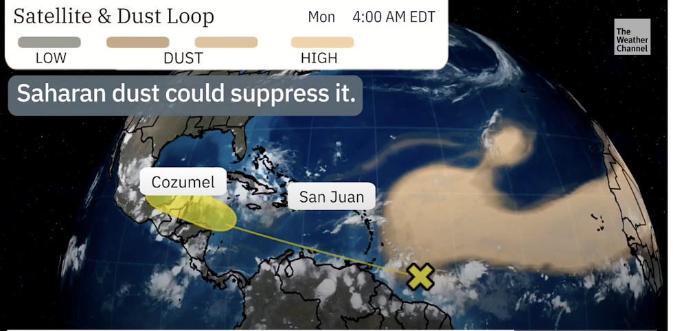
Saharan dust could see off tropical storm
The Weather Channel
A NOAA spokesman added: “Severe thunderstorms and heavy rainfall are likely across portions of the Northeast.
“An intense heat wave will continue across the Mid-Atlantic, where record high temperatures are likely.
“In the West, triple-digit high temperatures are possible in central and southern California, Arizona, and Utah.”
Warnings come as meteorologists watch a tropical disturbance grow off the east coast, the second since the official start of the hurricane season.
But the storm could be dampened by a plume of Saharan dust sweeping across the Atlantic, experts say.
Weather Channel meteorologist Dina Knightly said: “A tropical wave east to southeast of the Windward Islands is producing some thunderstorms that could slowly develop once it reaches the western Caribbean.
“This is an area that can typically see development in June, particularly with seawater temperatures being so high.
“However, there is a lot of Saharan dust, and that could suppress development before ever making it to the Caribbean.”


 US weather: Southern 100F heat plume to trigger 75mph ‘monsoon-like’ delugeThe Weather Channel





Post comments (0)