Britons are set to enjoy another week of fine weather as high pressure continues to dominate across the UK.
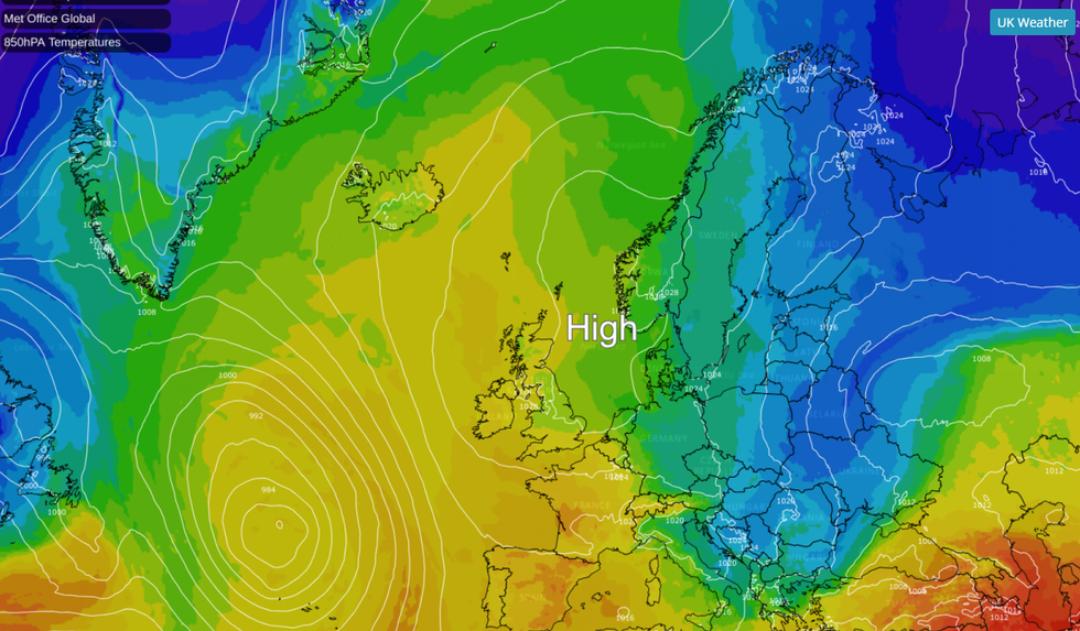
The persistent high pressure system is effectively blocking the usual Atlantic weather fronts, allowing sunshine to develop for most areas.
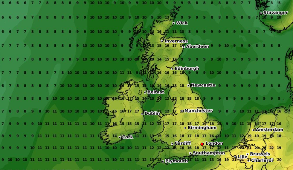
Daytime temperatures will feel pleasantly warm and generally above average for early April, particularly in inland areas away from coastal regions.
However, the clear skies that bring such pleasant days will also lead to chilly nights across the country, with rural areas facing a widespread risk of frost overnight as temperatures drop significantly after sunset.

Daytime temperatures will feel pleasantly warm and generally above average for early April
MET OFFICE GLOBAL / NET WEATHER
The week begins on a fine note with widely dry and bright conditions expected on Monday.
After a chilly start with potential frost and patchy fog, plenty of sunshine will develop throughout the day. Winds will remain mostly light, though the south coast may experience slightly breezier conditions on Sunday.
The pleasant warmth in the sunshine will be a welcome feature for many across the country.
Clear overnight skies mean the risk of frost continues into the new week.
MORE LIKE THIS:
This pattern of warm days and cold nights will be particularly noticeable in rural areas, where temperatures could dip below freezing after dark.
The settled weather pattern continues through the middle of the week from Tuesday to Thursday.
High pressure remains firmly in control, ensuring fine weather with plenty of warm sunshine across most parts.
However, those living along North Sea coasts should prepare for cooler conditions, as an easterly breeze will make coastal areas feel noticeably cooler than inland regions.

The persistent high pressure system is effectively blocking the usual Atlantic weather fronts, allowing sunshine to develop for most areas
WXCHARTS
Nights will continue to be rather chilly under clear skies. The risk of frost persists, especially in areas away from towns and cities where temperatures drop more significantly.
This contrast between warm days and cold nights will be a defining feature of the mid-week weather. As the week progresses towards Friday and Saturday, the weather outlook becomes less certain.
While initially the forecast suggests largely dry and sunny conditions will persist with above-normal temperatures for many.
However, meteorologists note growing uncertainty for the weekend period, as there’s an increasing possibility of a gradual shift towards more unsettled conditions.
This potential change could introduce showers, possibly heavy and thundery, pushing up from the south.
Alternatively, Atlantic fronts might bring rainfall accompanied by stronger winds, particularly in western areas.
The confidence in forecast details decreases for this later period. This potential shift could signal an end to the prolonged fine spell that the UK has been enjoying.


Post comments (0)