The US hurricane season is flexing for its next assault as the Atlantic stirs amid fears of Tropical Storm Sara.
Eastern states, including Florida still reeling from Hurricanes Helene and Milton, are back on alert for disruptive weather.
A ‘tropical wave’ in the Caribbean has erupted in conditions which experts say are favourable for storm development.
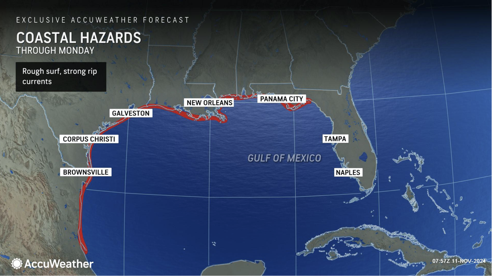
Coastal hazards threaten south-eastern states with Sara possibly likely before the end of the week.

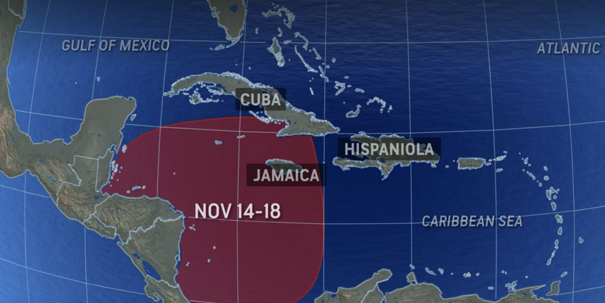
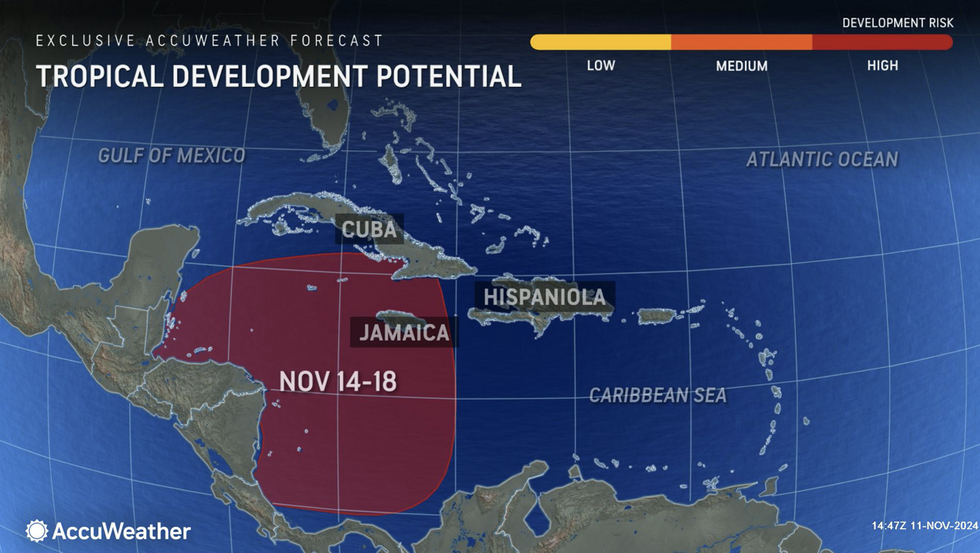
Tropical Development Potential map via AccuWeather – November 14-18
AccuWeather
AccuWeather meteorologist Bernie Rayno said: “Get ready for Sara, because we expect the next tropical storm to develop in the Caribbean this week.
“The development process is already underway, and there are showers and thunderstorms around Hispaniola that will move west.
“The storms will get a boost on Wednesday when wind shear starts to fade, and a front will provide more upward motion by midweek, helping these storms organise.”
Hurricane experts have issued a ‘high risk’ alert from Thursday into next week with Caribbean regions first in the firing line.
US LATEST:

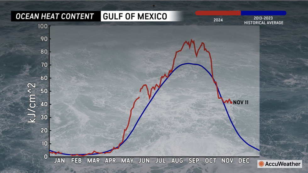
Ocean temperature chart
AccuWeather
Unusually high tropical water temperatures are driving a surge of storms beyond the end of the season.
Florida, which faces a multi-billion dollar clean-up bill already could again take the brunt of the assault.
AccuWeather lead hurricane expert Alex DaSilva said: “Don’t let your guard down just because the calendar says we’re heading into mid-November.
“Conditions and water temperatures in the tropics are still primed for tropical storms to form in the final weeks of hurricane season.
“History shows that Florida faces a higher risk of tropical impacts than any other state during the month of November.”
Sara would follow Sub-tropical Storm Patty and Rafael from earlier this month, and the much more powerful Milton earlier in the season.
Moisture and energy left from Rafael, which eventually fizzled with little disruption, may boost the next storm.
AccuWeather meteorologist Grady Gilman said: “We believe some of Rafael’s remaining moisture will be drawn northward into the central Gulf Coast region around the middle of the week as yet another non-tropical feature, a cold front, moves from west to east over the lower Mississippi Valley.
“A surge of tropical moisture from the ghost of Rafael could trigger heavy rainfall and localised flash flooding along parts of the Gulf coast Wednesday and Thursday.”
Meanwhile, torrential downpours and snow threaten the west coast as an ‘atmospheric river’ of rain sweeps in from the Pacific.
The US National Weather Service (NOAA) has storm warnings in force through the week along the coast.

Areas at risk from tropical storm Sara
AccuWeather
A spokesman said: “Another Pacific frontal system accompanying the Atmospheric River will approach the West, bringing a wave of Pacific moisture and triggering heavier rain to lower levels and higher mountain snow.
“The system will move inland bringing an expanding area of rain to lower levels and the coasts, and mountain snow to northern California.”
Jim Dale, US meteorologist for British Weather Services and co-author of ‘Surviving Extreme Weather’, said: “Very heavy precipitation is forecast in the northwest through the week, and this is coming off the Pacific with the potential for snowfall over higher ground.
“To lower levels, the rain will be the bigger concern.”





Post comments (0)