New weather maps forecast that up to 20 centimetres of snow is set to lash the UK as a -14C Arctic ice bomb unleashes hell on Britain in early February.
Mercury will likely drop drastically by next week as many Britons face freezing conditions by Thursday.
However, wintery weather is set to hit all corners of the UK by February 10.
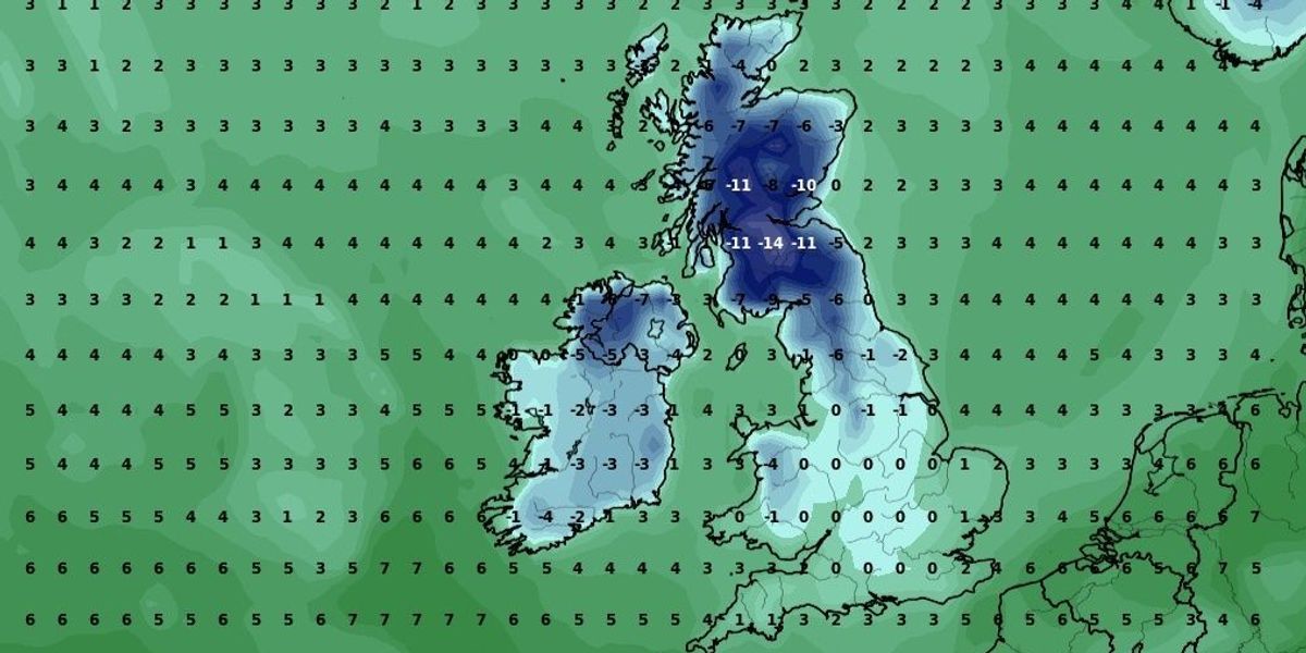
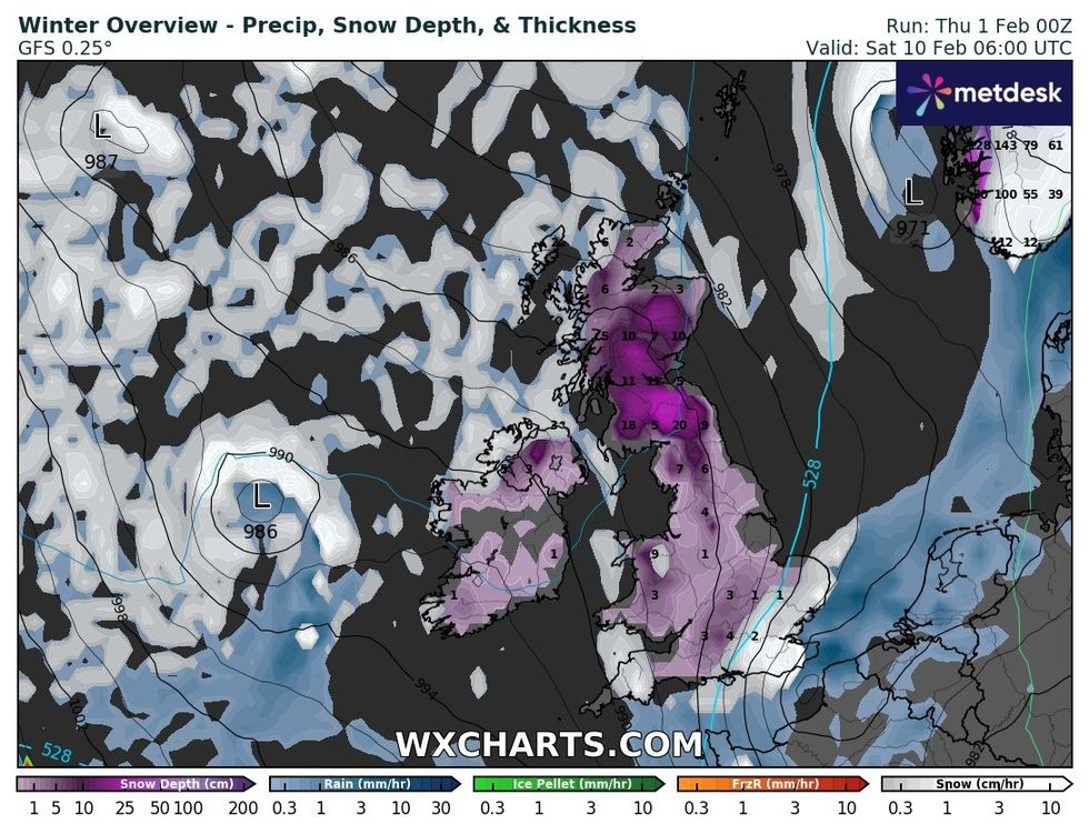
Scotland could see the mercury drop to as low as -14C as two low-pressure zones to the west of the UK will drag cold Arctic air across Britain, maps on WXCHARTS show.
WATCH NOW: Aidan McGivern gives GB News viewers the latest weather forecast
Wales could witness temperatures fall to -4C in Gwynedd and Northern Ireland will also see a freeze of around -7C.
England will likely remain somewhat milder than the rest of the UK, with much of the country teetering towards freezing.
However, the North of England could witness similar temperatures to the Celtic corners of the country at just -6C.
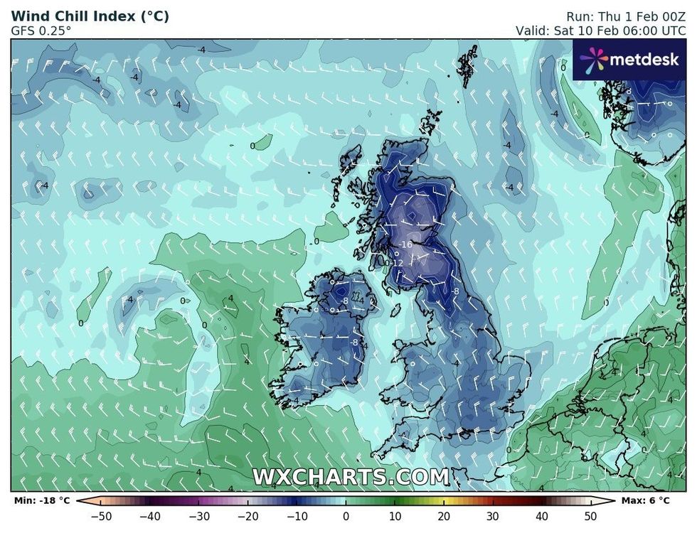
WXCHARTS’ wind chill index shows the whole of the UK will feel the bite, including the often milder South of England.
LATEST DEVELOPMENTS:

A winter overview from February 10, WXCHARTS
WXCHARTS

Wind chill could bring a bite to the South of England
WXCHARTS
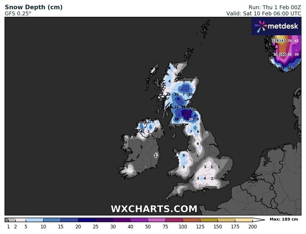
The chill will also likely bring snowfall as up to 20 centimetres could fall in the Scottish borders.
Nine centimetres of snow is expected to shower North Wales and much of the UK risks being blanketed over the weekend.
Snow could continue to fall across the country throughout the following week.
Temperatures will also likely continue to hover below freezing.

Snow depth across the UK on February 10
WXCHARTS
The Met Office is also predicting the return of wintery weather by next week.
In its long-range forecast lasting until Valentine’s Day, the UK’s national weather service claimed: “There is a chance colder conditions could then start to feature slightly more widely during the second week of February, with increased chance of wintry weather across northern parts of the UK.
“Cloud and rain being pushed in from the Atlantic may well be forced to track further south across the south of the country where it may remain milder.
“However, confidence is fairly low in this period.”






Post comments (0)