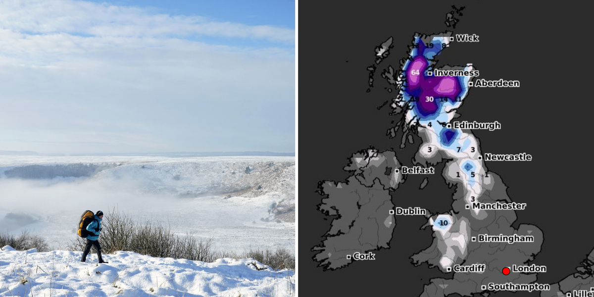
Britons should brace themselves for a bitterly cold start to the New Year, as new weather maps show “heavy snow” across the UK, accompanied by a -8C icy blast.
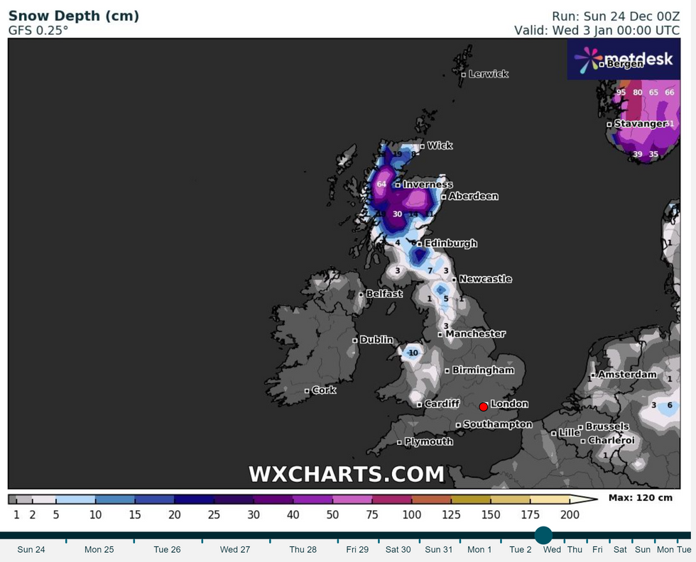
New weather maps from WX Charts show a staggering amount of snow settling in parts of the UK on January 3.
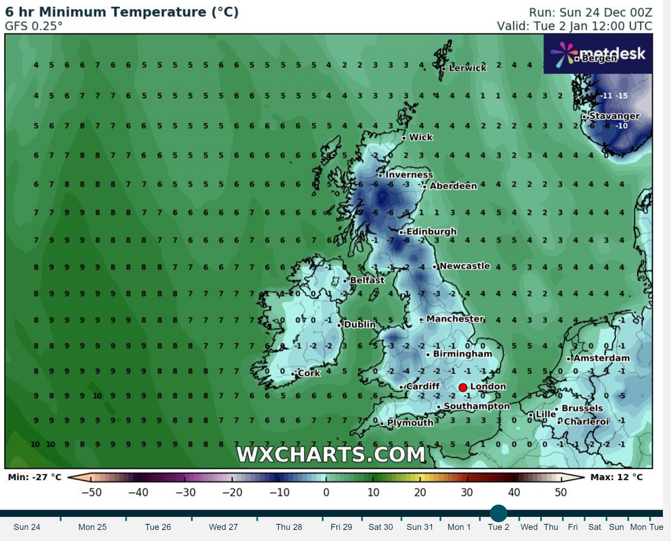
Alongside the heavy snowfall, temperatures will plummet to a bone-chilling -8C on January 2.
Scotland will feel the effects of the icy blast the strongest, with the largest amount of snow falling in the Highlands.

Scotland will see the most snowfall as an icy blast at the start of 2024 threatens to rear its head
WX Charts
On lower land, snowfall as high as 30cm is expected, whilst on higher terrain, up to 65cm of snow is predicted.
Near Edinburgh, WX Charts has forecast around a snow depth of 20cm.
Across many parts of the UK, temperatures will drop to a negative mercury as January begins.
Edinburgh will drop to a bitterly cold -8C, with Scots once again facing the brunt of the cold weather.
WEATHER LATEST:

Temperatures will plummet to -8C
WX Charts
It was due to a Sudden Stratospheric Warming (SSW), which blocked the westerly flow of the jet stream, allowing roaring winds in from the east to travel over the UK.
Another SSW event is expected in early 2024 and this, experts say, could trigger an early cold blast.
James Madden, forecaster for Exacta Weather, said: “The risk is growing for a prolonged cold and snowy spell as we head into the early part of January.
“This is due to the risk growing for another SSW event within this period, and this could bring the threat of another Beast from the East in early 2024.
“There are now strong indications for a major SSW to occur during the early part of January, and if it does, many parts of the UK can expect to end up in the freezer with snow events and severe cold weather.”





Post comments (0)