Dramatic changes in Pacific ocean temperatures threaten one of America’s ‘hottest summers on record’.
A near-nationwide heatwave could begin as soon as next month, as meteorologists sound alarm bells for weeks of extreme weather.
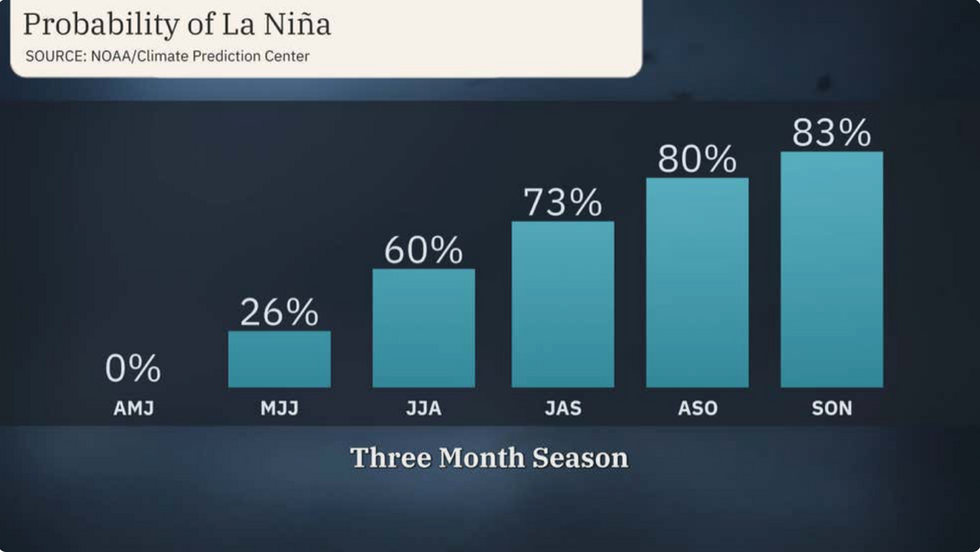
They blame a weakening El Nino in the eastern Pacific and a growing risk of it pendulum swinging into La Nina.
El Nino–abnormally high sea temperatures off the coast of Peru– set in last summer and grew to one of the strongest on record.

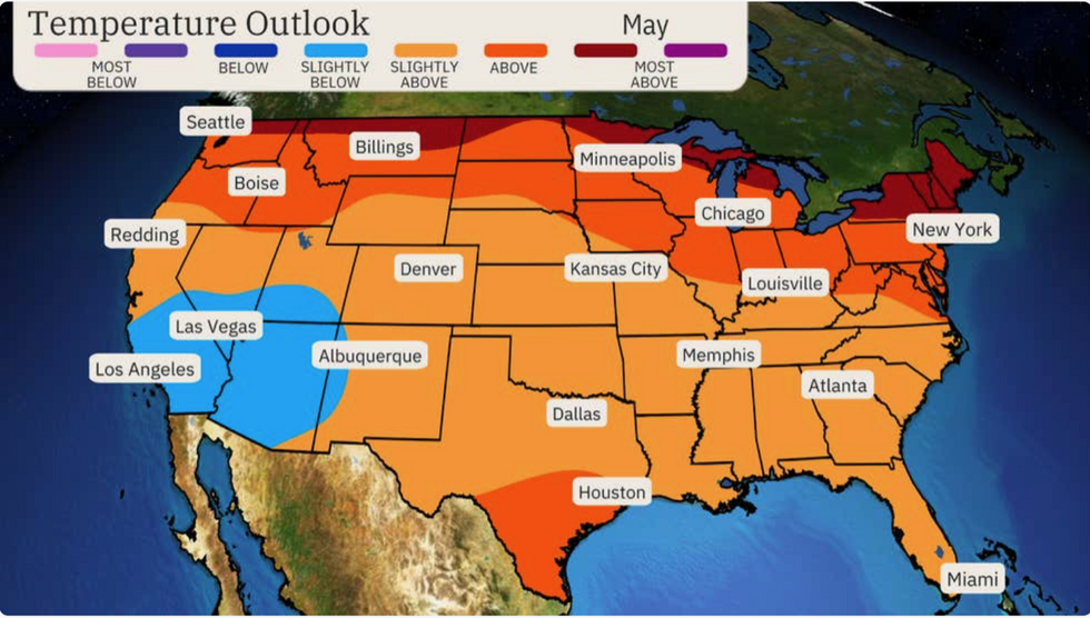
The southwest could see cooler than average temps
The Weather Channel
Its rebound, La Nina, is expected in the coming months, and could drive ocean temperatures well below normal.
This, experts warn, will affect global weather patterns, and could push the United States into a summer scorcher.
Weather Channel meteorologist Madeline Scheinost said: “This summer could be one of America’s warmest on record.
“Part of the reason is that there is an expectation that later this summer, El Nino will change to La Nina.
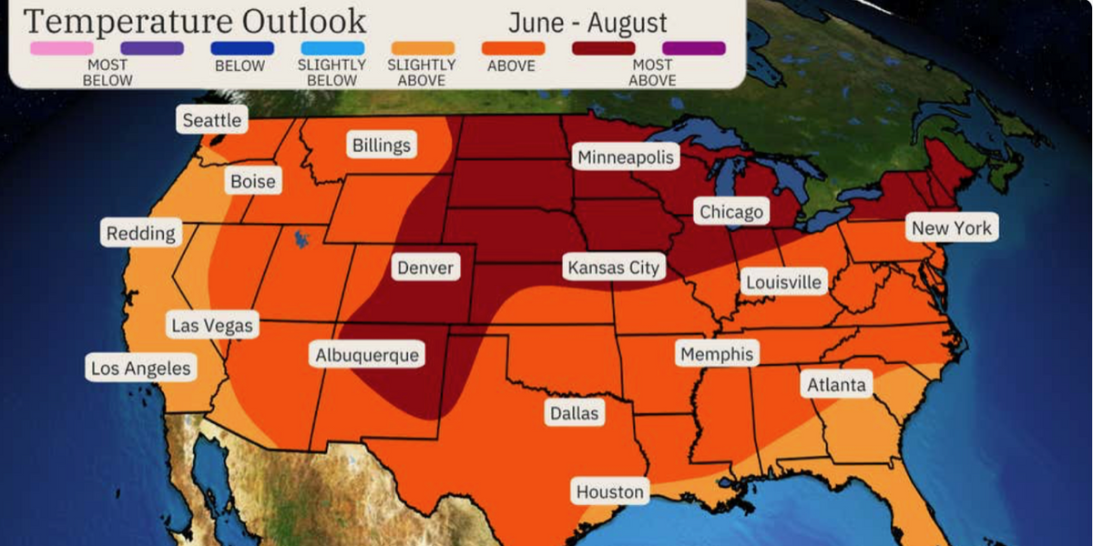
“Near average temperatures are most likely across parts of the West, but into July, warmer-than-average temperatures are expected to become more widespread and intense.”
Temperatures will start to increase during May, although the peak of the heat is expected during the late summer, she warned.
She said: “We expect to see the hottest temperatures in August, compared to the average across the nation.
“Overall, temperatures are expected to be far warmer that average across much of the nation this summer.”
LATEST DEVELOPMENTS:

Growing risk of La Nina
The Weather Channel
This summer could be one of the hottest on records, according to long-range models researched by meteorologists at Atmospheric G2.
Western regions and the Gulf Coast will stay closer to average though still unusually warm.
The ‘core’ of the heat will strike central regions including Texas, New Mexico, Kansas, and Minnesota, according to The Weather Channel.
Southern California and Arizona may, conversely, kick-start summer with cooler than average temperatures.
Ms Scheinost added: “The highest temperatures compared to average are likely to shift northwards in July, stretching from the Desert Southwest into the Northern Plains, Ohio Valley and Northeast.”
America lies in a part of the world where the weather can be heavily influenced by La Nina and El Nino.
El Nino set in last summer and was quickly dubbed a ‘super El Nino’ when temperatures in the Pacific rocketed.
The phenomenon is caused when the easterly Trade winds slow or reverse, preventing warm waters being steered away from the South American Coast.
The impact of El Nino and its influence on the Asian and Australian monsoons, including intense prolonged rain, can be devastating.
La Nina brings a separate catalogue of hazards and is part drive of the summer alarm bells.
Sea temperatures higher than normal after hot weather last year may also help boost temperature through the coming months.
Jim Dale, meteorologist for British Weather Services and co-author of ‘Surviving Extreme Weather’, said: “The seas are still warmer than usual after last summer, and this will drive warmer temperatures in parts of the US through this summer.”
Temperatures will start to rise in the southwest this week while northern regions shiver in a late winter chill.
A spokesman for the National Weather Service (NOAA) said: “As high pressure weakens and slides east, a gradual warm up can be expected east of the Rockies.”


Post comments (0)