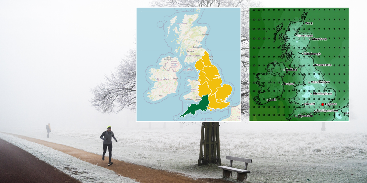
The Met Office and the UK Health Security Agency (UKHSA) have issued a yellow cold weather alert for almost all of the UK, warning of a “greater risk of life” to vulnerable people as temperatures drop below freezing.
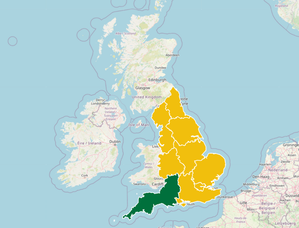
The warning covers huge swathes of Britain, stretching from Plymouth, across to Wales, and up to the border of Scotland.
Covering eight regions, the warnings begin at 6pm on January 17 and last until January 21 at 9am – a total of three days and 15 hours. Only the south west remains alert-free.
Issuing the regional alerts, the Government agencies said: “Forecast weather is expected to have minor impacts on health and social care services, including; increased use of healthcare services by vulnerable people; greater risk to life of vulnerable people.”

The cold weather alert covers eight regions
UKSHA
The incoming cold snap will likely be of no relief to Britons, who have just faced bitterly cold conditions over the weekend.
In the Scottish Highlands, readings dipped to as low as -18.9C, though a dramatic turnaround saw the mercury shoot up to 11C in the same region on Monday morning.
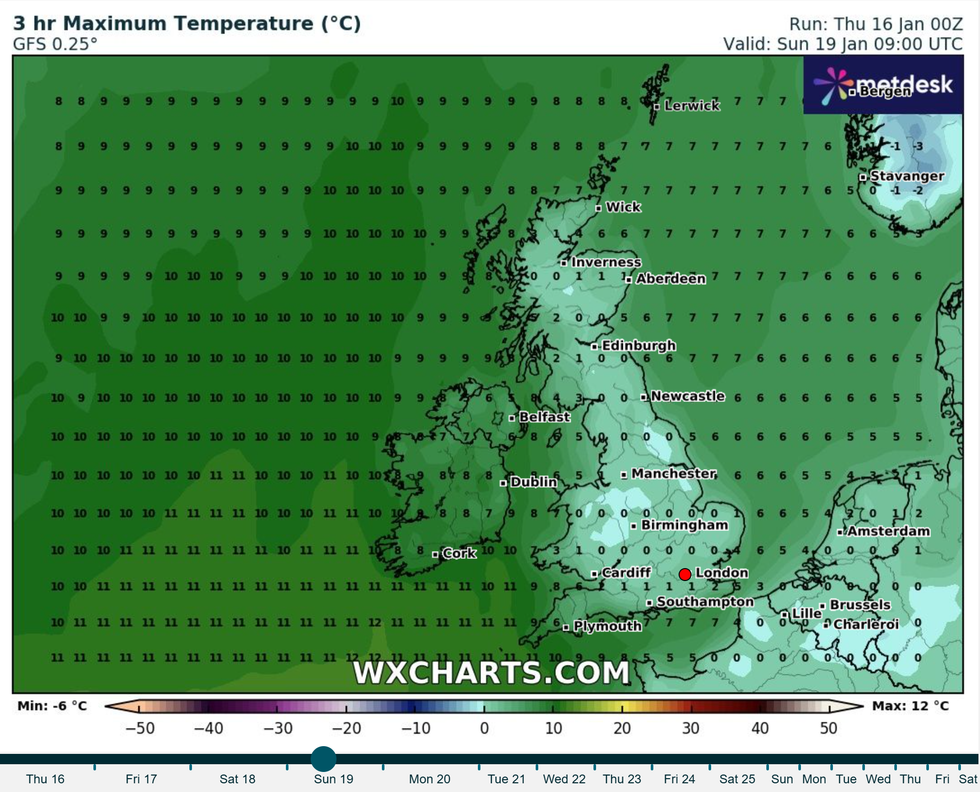
And whilst this weekend will be nowhere near as chilly as the one before, Britons will certainly need to wrap up warm as below-freezing temperatures are expected.
Forecasts from Netweather predict that on January 19, the mercury will dip to -1C.
LATEST DEVELOPMENTS:

Temperatures are set to drop below freezing this weekend
WXCharts
The yellow alerts replaces orange alerts that were issued by the agencies at the beginning of this week.
In place until 9am on January 14, the alert warned that “forecast weather is likely to cause significant impacts across health and social care services”.
Looking ahead to next week the Met Office predicts that there could be a risk of ‘snow showers’ as temperatures take a turn to the colder side.
A long-range forecast for January 21-30 said: “The early part of next week will see fairly quiet, and for most, dry weather with variable amounts of cloud and often light winds.
“The greatest chance of any rain is likely to be in the far northwest of the UK, and possibly as well in the far south.
“There is a small chance rain could become more widespread, especially mid-week, and temperatures are expected to be around average.
“Later in the week, periods of much wetter and windier weather will most likely eventually become more prevalent, from northwest to southeast.
“Ahead of this a colder, more settled southeasterly wind may develop for a time.
“There is a small chance however, that alternatively winds could turn much more easterly, and colder, bring the risk of snow showers.”


Post comments (0)