Americans face Independence Day storm hell as a trio of tropical tempests barrels in steered at the helm by Hurricane Beryl.
The National Hurricane Centre has flagged three tropical storms in the Atlantic, including Beryl – the first named hurricane of the season.
While these make a beeline for the Caribbean, southern states face the knock-on from a colossal storm surge.
Searing heat will drive a separate spate of ‘home-grown’ storms this week as the nation braces for torrential downpours and ‘damaging winds’.

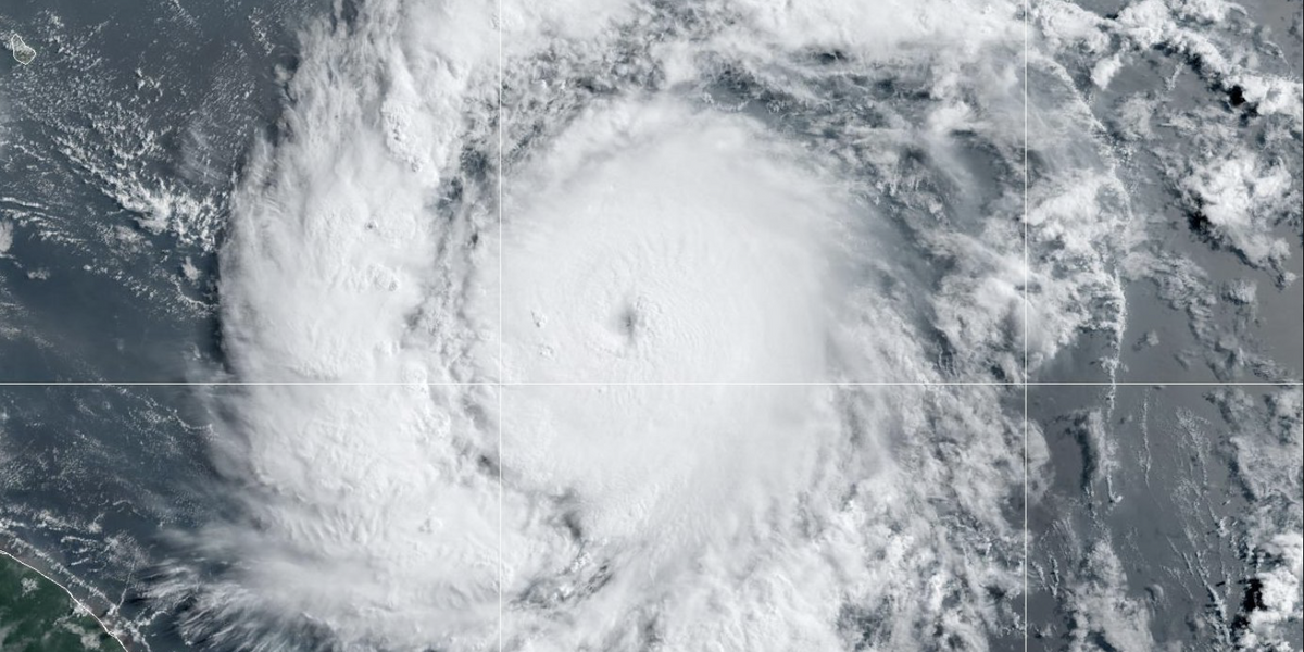
Beryl is the first named hurricane of the season
National Weather Service/X
Jim Dale, US meteorologist with British Weather Services, said: “Beryl looks like it will barrel into the south of the US at the start of the week, but it is one of three systems in the region.
“This is going to be something to watch, because although they are heading southwards towards the Caribbean, there could be some impact to Florida and southern Texas in terms of coastal flooding and storm surge.
“However, this is the first named hurricane of the season, and a sign that the hurricane season is not really brewing up.”
A surge of heat from the south pushing temperatures past 100F will drive further storms more widely inland.
The worst of the onslaught is expected to kick in on Thursday, as millions of Americans celebrate Independence Day.
A deeply unstable atmosphere will trigger widespread thunderstorms, torrential rain and the risk of tornadoes.
Mr Dale said: “The real risk of storms gets going around the fourth of July, and this will affect many regions as hotter air from the south hits cooler air to the northwest.
“These are homegrown and separate from what is going on in the tropical Atlantic further south.
LATEST DEVELOPMENTS:

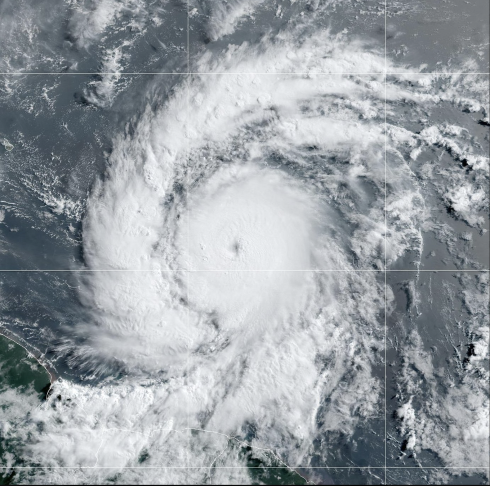
Hurricane Beryl is expected to hit Category-4 status through the start of the week with hurricane-force winds driving a ‘life-threatening’ storm surge
National Oceanic and Atmospheric Administration
“One of these systems appears to go right through Texas by next weekend, but widely, the US will be covered with thunderstorms.”
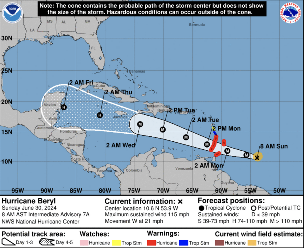
Hurricane Beryl is expected to hit Category-4 status through the start of the week with hurricane-force winds driving a ‘life-threatening’ storm surge.
Warnings are in force across the Windward Islands where torrential downpours and flooding are a risk.
A National Hurricane Centre spokesman said: “Beryl is expected to be an extremely dangerous Category-4 hurricane when it reaches the Windward Islands early Monday, bringing destructive hurricane-force winds and a life-threatening storms surge.”
Weather Channel meteorologist Kelly Cass said: “Beryl is a major hurricane, a category-3.
“There has been a dramatic pressure drop, and we have seen a lot of lightning right around the eye wall, and rapid intensification has been going on since yesterday.”
The US National Weather Service (NOAA) has separate warnings in force for storms and flooding across mainland America.

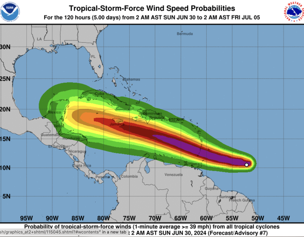
The worst of the onslaught is expected to kick in on Thursday, as millions of Americans celebrate Independence Day
National Oceanic and Atmospheric Administration
Potent systems will target the East Coast, Midwest, southwest and Four Corners regions.
A NOAA spokesman said: “A few storms could turn severe between Maine and the Carolinas, with damaging wind gusts the primary weather hazard.
“Heavy rain could also lead to isolated flash floods between New England and the Southeast.
“The flash flood threat is expected to be highest across coastal South Carolina and southeast Georgia, where slow-moving storms could produce a few inches of rainfall in a very short period.”
NOAA is watching two separate tropical disturbances in the tropical Atlantic – ‘Disturbance 1’ and ‘Disturbance 2’.
As with Beryl, these are expected to track south of the US through the coming days.
Beryl is unusually powerful for the time of year, having reached Category-3 strength this early in the season.







Post comments (0)