America faces a multi-pronged storm assault as ‘dangerous desert heat’ ignites ‘fireworks’ while a historic hurricane smashes the Atlantic coast.
Almost the entire country is braced for either searing temperatures, thunderstorms, giant hail or the risk of flooding.
Southern coasts face a knock-on impact from Hurricane Beryl–the earliest Category-5 hurricane ever recorded.
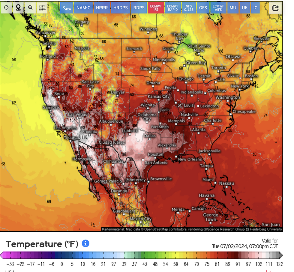
The primary driver of inland storms will be temperatures soaring into the 110Fs, destabilising the atmosphere.

Almost the entire country is braced for either searing temperatures
Weather.us
AccuWeather meteorologist Brett Anderson said: “The surge of heat will intensify by the middle of the week, bringing record-challenging temperatures to parts of California, Arizona, New Mexico, Utah, Nevada, Oregon, and Idaho.
“A significant heat wave may bring both record daily high maximum and minimum temperatures to the West Coast.
“Afternoon temperatures will likely surpass the 110-degree mark during the late afternoon across portions of the Central Valley of California between Tuesday and Thursday.”
Severe weather on Thursday threatens to hamper Independence Day celebrations for millions of Americans.
Raging heat will fire off spates of violent thunderstorms, driven by powerful winds and tornadoes
US LATEST:

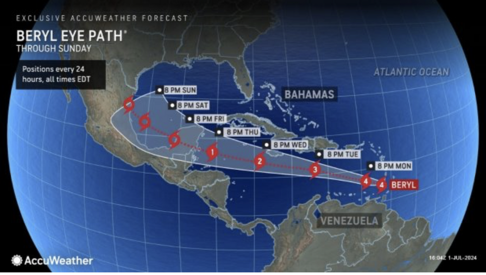
Path of Hurricane Beryl
AccuWeather
Torrential rain across the Midwest threatens flooding while coastal regions could be hit by the tail end of Hurricane Beryl.
The hurricane, the first to hit Category-5–the strongest level–in July will make a direct hit with the Caribbean over the coming days.
A spokesman for AccuWeather said: “Beryl could bring some rain and wind impacts to southern Texas this weekend with a lower risk of impacts from Houston and points east.
“A new tropical threat could bring more flooding rainfall to islands hit hard by Hurricane Beryl later this week.”
Inland storms will strengthen towards the middle of the week, as temperatures continue to rocket.

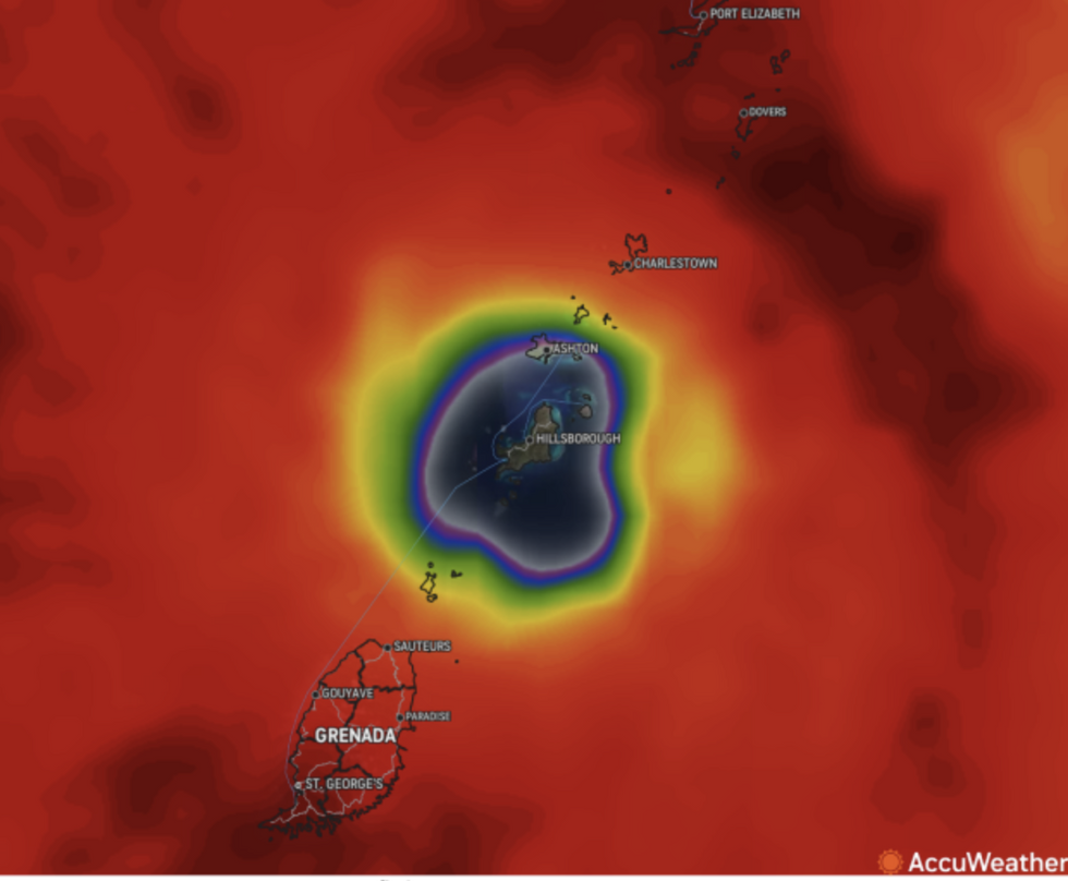
Hurricane Beryl’s eye
AccuWeather
Jim Dale, US correspondent and meteorologist for British Weather Services, said: “The storms get going around Thursday, and will be the result of extreme heat mixing with cooler air to the north and going bang.
“These temperatures are extreme, and we are looking at a plume of desert heat coming in from the south.
“In terms of storms, these are really going to kick off around Independence Day.”
The US National Weather Service has a raft of alerts in place for ‘excessive heat’, flash flooding and wildfires.
A spokesman said: “Dangerously hot conditions this week will impact much of the southern Plains, the lower Mississippi Valley, and the western United States.
“This magnitude and duration of heat could pose a danger to the public if proper heat safety is not followed.
“Active and stormy weather associated with a few storm systems progressing from the northern Rockies to the Midwest this holiday week will create fireworks of their own.”
Experts have issued warnings to take extra care, especially when spending long periods in the outdoors.
AccuWeather’s Anderson said: “Extreme caution should be taken to protect yourself from the heat and blazing sun next week if you have to be outside for an extended period of time, especially during the afternoon and early evening hours.”







Post comments (0)