Weather forecasters have warned that Hurricane Beryl has become a “record-breaking” event as it is expected to hit Jamaica later this week.
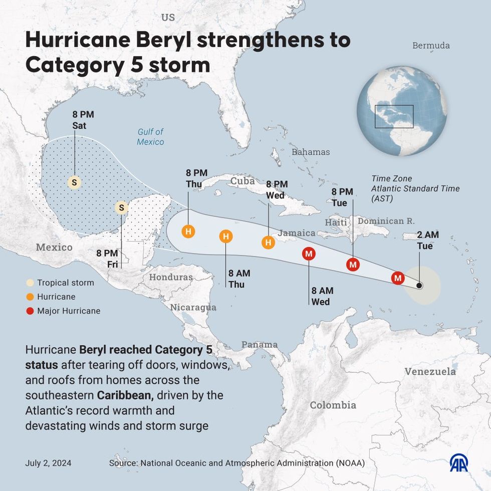
The Category 5 storm swept through Grenada and St Vincent and the Grenadines, leaving many households without power, and is expected to hit the Cayman Islands later in the week.
A Category 5 hurricane brings winds of 252 kilometres an hour (157 miles per hour) or higher, making it capable of causing catastrophic damage including the destruction of homes and infrastructure.
Climate scientists have now said that it is the earliest Category 5 Atlantic Hurricane on record, which they said sets the tone for a “very dangerous” hurricane season.

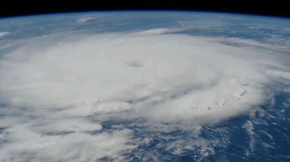
Hurricane Beryl seen from the International Space Station
ISS/Reuters

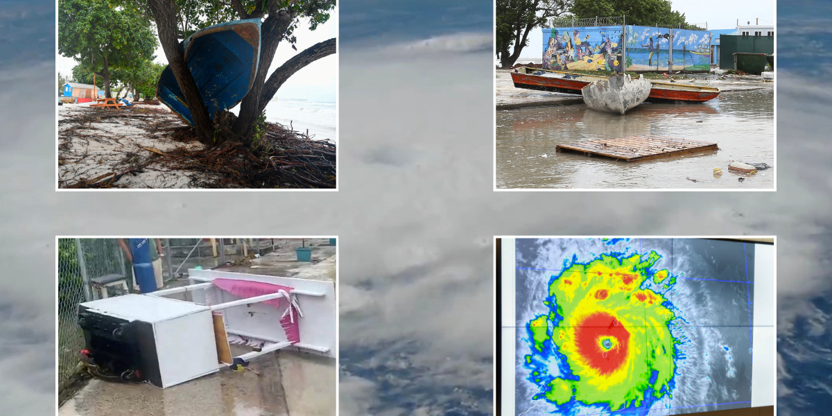
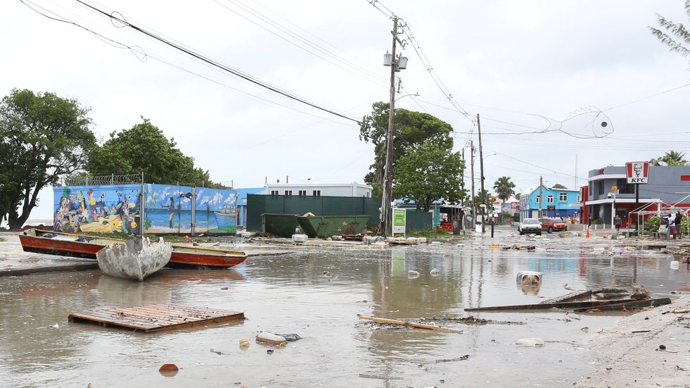
The aftermath of Hurricane Beryl, in Bridgetown, Barbados
@alanburke__ via REUTERS

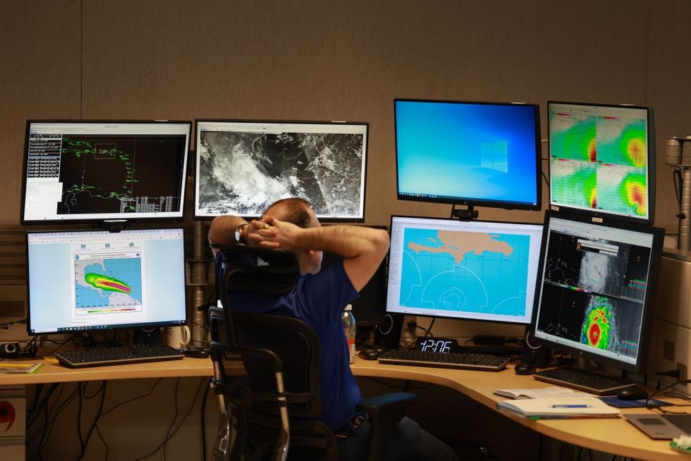
Brad Reinhart, Senior Hurricane Specialist at the National Hurricane Center, works on tracking Hurricane Beryl
Getty
World Meteorological Organization (WMO) spokesperson Clare Nullis told reporters: “It’s the earliest Category 5 hurricane on record in the Atlantic, Caribbean and Central American basin.
“It sets a precedent for what we fear is going to be a very, very, very active, very dangerous hurricane season, which will impact the entire basin…We need to bear in mind that it only takes one land-falling hurricane to set back decades of development.”
“We fear what is happening with Hurricane Beryl, which has hit very, very small islands in the Caribbean that are not used to this size of hurricane.”
Scientific officer for the WMO Tropical Cyclone Programme Anne-Claire Fontaine said warmer ocean temperatures was one reason why it was hitting so early in the season, adding: “The Main Development Region (MDR), the place in the ocean where the hurricanes are developing… is the warmest ever.”
LATEST DEVELOPMENTS:

The aftermath of Hurricane Beryl, in Bridgetown, Barbados
@alanburke__ via REUTERS

The pathway of Hurricane Beryl
Getty/NOAA

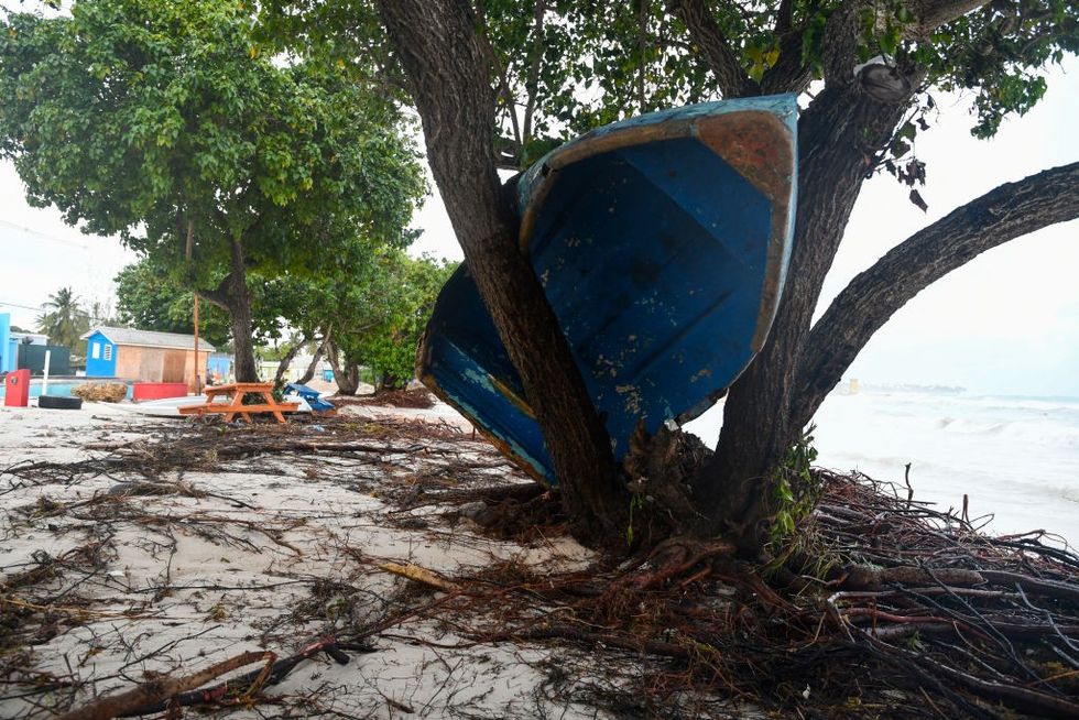
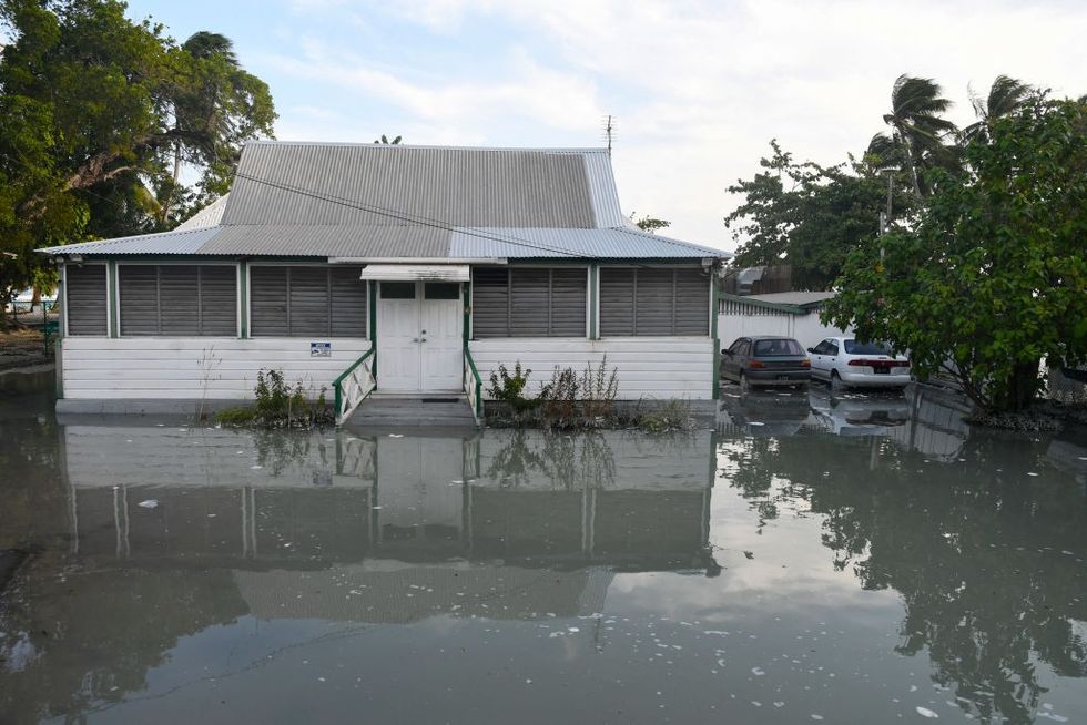
Oistins gardens, Christ Church, Barbados
Getty
Jamaica issued a hurricane warning on Monday, while tropical storm warnings were in effect for parts of the southern coasts of the Dominican Republic and Haiti. At the Chillin’ restaurant in Kingston, waiter Welton Anderson said he felt calm despite the hurricane’s approach.
He said: “Jamaicans wait until the last minute. The night before or in the morning, the panic sets in. It’s because we’re used to this.”
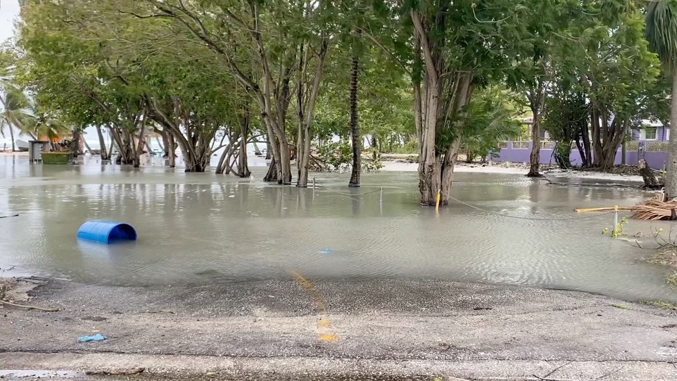
Across other islands in the eastern Caribbean, residents had boarded up windows, stocked up on food and fuelled up cars as the storm approached. Earlier on Monday, vehicles were seen driving through a flooded boardwalk in Bridgetown, Barbados.
The St. Vincent community of Prospect reported roofs ripped off buildings and power cuts in some areas. In Grenada, it has been reported power was down island-wide.

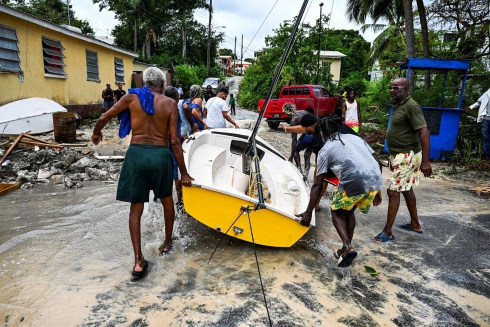
Residents clear a boat from the street as it gets flooded after the passage of Hurricane Beryl in the parish of Saint James, Barbados
Getty

Flooded business are surrounded by water are seen after the passing of Hurricane Beryl in Worthing, Christ Church, Barbados
Getty
Christopher Rozoff, an atmospheric scientist at the United States National Center for Atmospheric Research, said: “Climate change is loading the dice for more intense hurricanes to form.”
Scientists have already predicted that events like Beryl will grow more likely with climate change, added Garner, whose research has shown rising water temperatures over the last five decades have made it more than twice as likely for weak storms to grow into major hurricanes within less than 24 hours.
Meanwhile, on the island of Tobago, a hotel and tourism group said limited damage had been reported to hotel properties.
Curtis Douglas, president of the All Tobago Fisherfolk Association, said: “The eastern side of the island got the most battering and the seas remain dangerous. Fisherfolk got sufficient warning and were able to remove their boats from the water.”






Post comments (0)