Storm-battered Britain is back on “heatwave” alert with a Spanish-French combo heat blast forecast to push temperatures to 30C.
As Storm Floris’s 90mph assault clears into the North Sea, weather patterns will once again shift to bring summer’s return.
High pressure from the west – the sunshine-steering Azores High – will sweep into Britain from today.
Thermometers across parts of the country could surge beyond the monthly norm by the weekend, experts say.
Met Office meteorologist Alex Burkill said: “The most likely set up for Tuesday is high pressure building to the west.
“If we move forward a few days, we are still going with the idea of high pressure across southern and southwestern parts, or across much of the UK, so it is going to turn largely dry.
“As we see high pressure returning, there are signs that temperatures will rise, particularly towards the south, and if we take London, there is a good chance that we could see temperatures rising a good few degrees above average.”
Warm weather could hold out for a week in part of the country before the risk of storms returns, he said.

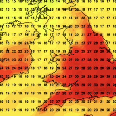
WXCHARTS
|
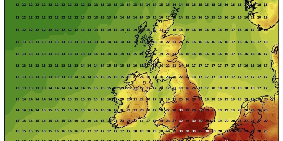
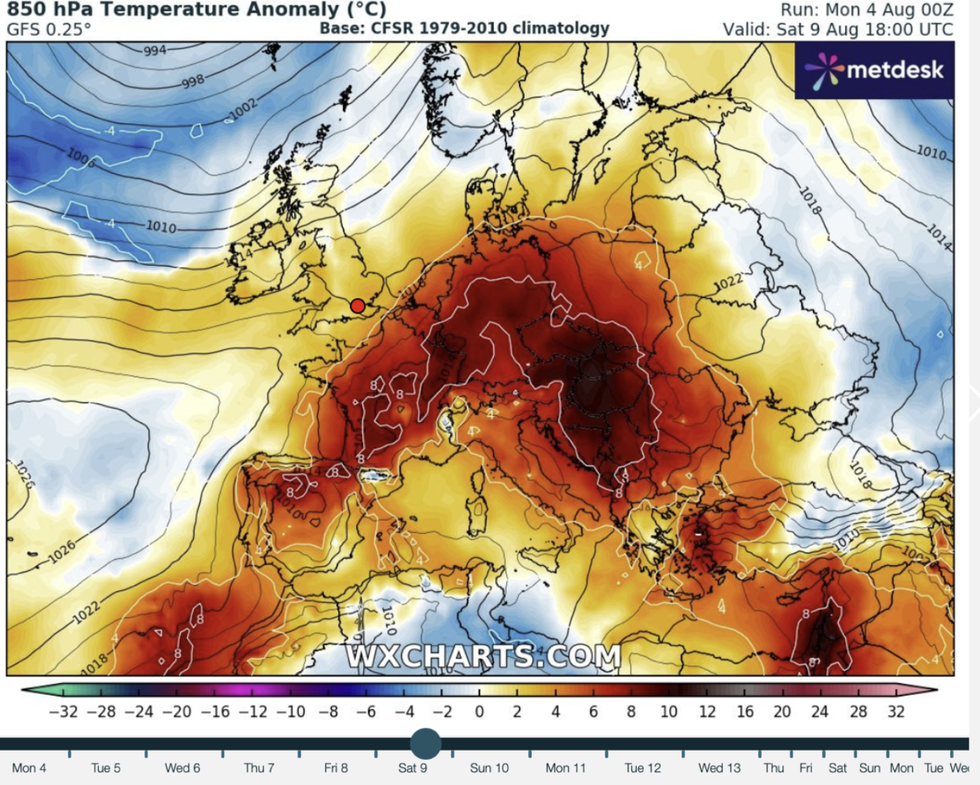
A map of the UK on August 9 by temperature anomaly
He added: “This could last to the end of the week or even a bit longer, but then we could see low pressure return especially to parts of the northwest with a slight change to something a bit more unsettled.”
Britain could be facing the fourth heatwave of summer with hot weather hinting at stretching beyond the weekend.
A heatwave is defined as three or more days of threshold temperatures, 28C in London and the south.
Jim Dale, meteorologist for British Weather Services and social commentator, said: “By the weekend we are looking at above-average temperatures which will be driven by heat in Spain and France which is going to feed into our weather.

WXCHARTS
|
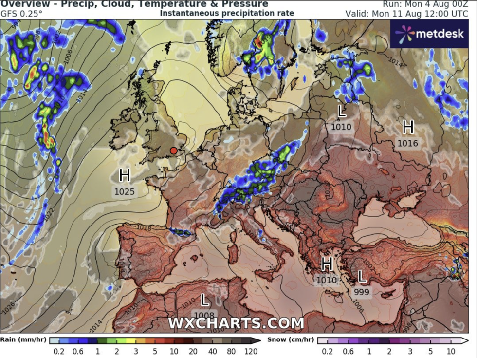
The UK weather map overview on August 11
“There is every chance we could see another 30C, and this could hold out through the start of the following week.
“With this, there is a distinct chance that we will be back in heatwave conditions at some point.”
Warm sea and ground temperatures after the hot spring and summer will drive the next heatwave.
However, southern Britain will feel the force of the furnace while Scotland and northern England stay cooler.

WXCHARTS
|
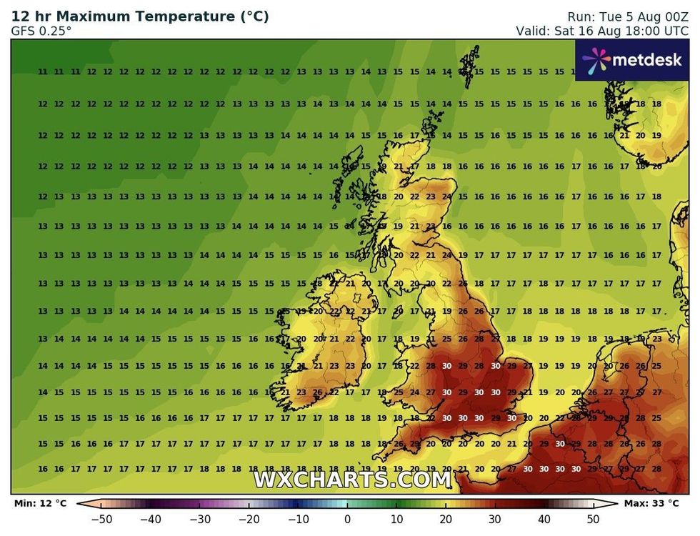
WXCHARTS weather map on August 16
Dale said: “I don’t think Scotland and northern Britian are going to see the hot weather as much as the rest of the country.
“But with that said, summer is definitely not over.”
Hints of another hot blast come as meteorologists confirm July was the fifth warmest on record.
Average temperatures by both day and night have been higher than normal, driven by a series of heatwaves.
Met Office scientist Emily Carlisle said: “Provisional Met Office data shows that this July was the fifth warmest on record since 1884.
“It’s now the sixth consecutive month with above-average mean temperatures in the UK, with only January falling below average this year.
“July also saw below-average rainfall, making it the sixth month this year with drier-than-average conditions across the UK.”
Storm Floris will depart leaving a few days of calmer conditions, with only the odd shower hanging over.
Jason Nicholls, lead international forecaster for AccuWeather, said: “A few showers may linger on Tuesday after Storm Floris.
“Then on Wednesday, many parts of the country will be dry and sunny.”


Post comments (0)