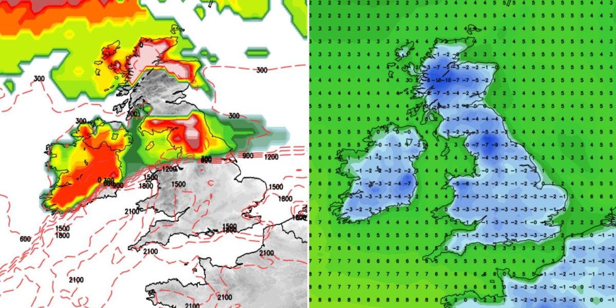
Britons face New Year’s weather chaos as three storms collide in a melee of Arctic fury to unleash a bone-numbing -17C blast of winter misery.
After months yo-yoing between bitter cold and storms, the UK is about to be hit by a Polar-tempest combo.
A trio of Atlantic cyclones starting on New Year’s Eve threaten 70mph gales, torrential rain and snow, as temperatures plunge to minus 17C.
Severe weather led to the cancellation of Scotland’s Hogmanay celebrations tonight with storms forecast through the week.

A trio of Atlantic cyclones starting on New Year’s Eve threaten 70mph gales, torrential rain and snow, as temperatures plunge to minus 17C
Net Weather
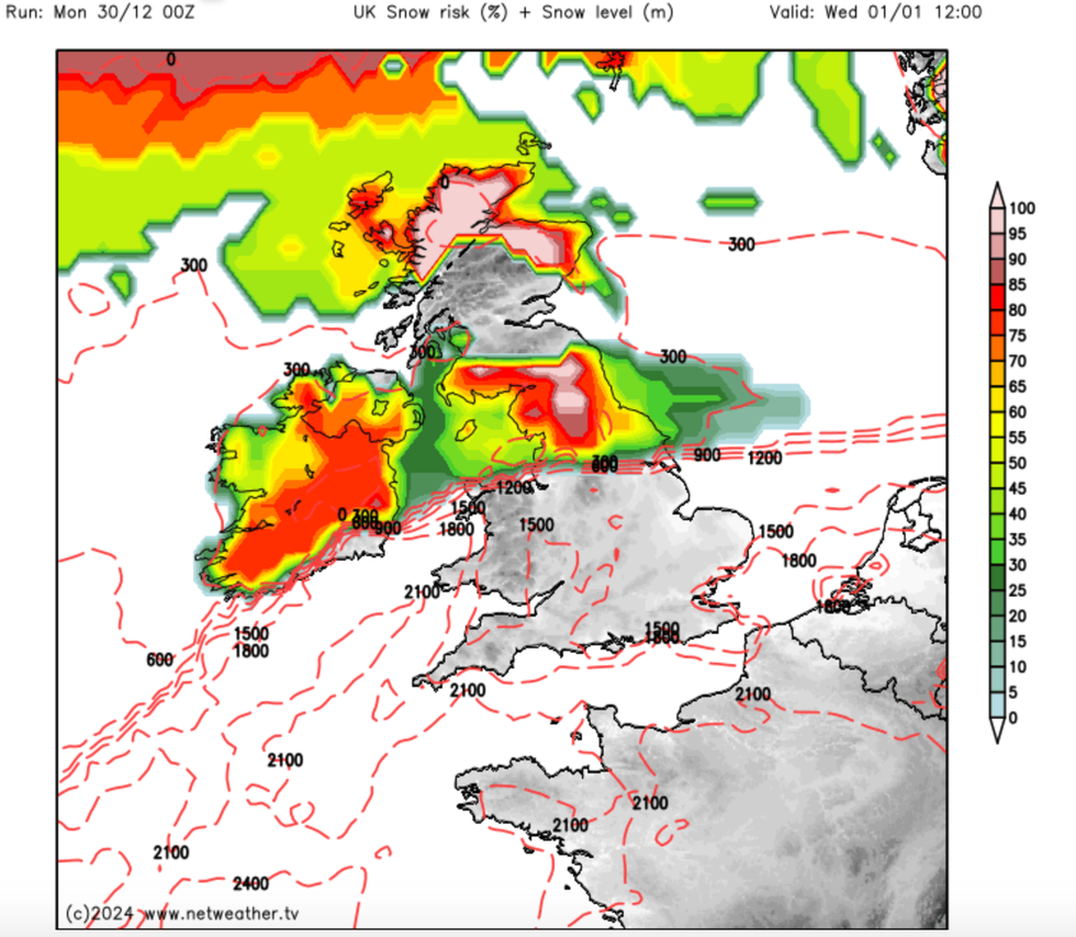
Jim Dale, meteorologist for British Weather Services, said: “The weather changes dramatically from New Year’s Eve, and it is Scotland that will bear the brunt of the first storm which threatens disruption from multiple hazards including rain, snow and strong winds.
“This is going to have teeth, particularly in terms of wind and snow, and could quite possibly earn a storm name which would be Eowyn.
“There are several storms lined up, with a second on New Year’s Day, and another towards the end of the first week of January.”
Foul weather will hit northern Britain first before moving south through New Year’s Day and the start of 2025.
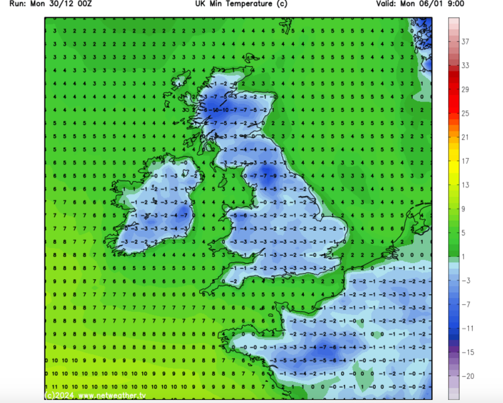
As winds spill in from the Arctic, thermometers will plunge widely with the most exposed parts nudging minus 17C.
Dale said: “This is going to be the first proper taste of winter, as so far we have not really seen anything wintry with the capability of causing disruption to this extent.
LATEST DEVELOPMENTS:
“But this is going to come in from the Arctic and Scandinavia, bringing the potential for heavy and disruptive snow and very cold winds.
“Temperatures in the Glen and Highlands over the next week could possibly drop to minus 16C or minus 17C.”
The start of 2025 will signal a change from the pattern of winter so far of cold but calm snaps followed by milder, Atlantic storms.
Storm Darragh which triggered a red wind warning at the start of the year, though powerful, arrived wrapped in a westerly warm front.
While winds whipped up to 90mph-plus, Britain was spared the added misery of icy cold and snow.

Britons face New Year’s weather chaos as three storms collide in a melee of Arctic fury to unleash a bone-numbing -17C blast of winter misery
Net Weather
The outlook this time is different, with the next storm to track much further north, pulling in winds from the Arctic.
Government forecasters have issued a slew of warnings for wind, rain and snow across Britain through the holiday period.
Met Office chief forecaster Andy Page said: “There is a very complicated weather forecast with snow, strong winds and heavy rain all feature for parts of the UK.
“Almost the entire UK is covered by at least one weather warning during the coming week, and with such a varied and complex weather situation there is potential for the pattern of warnings to shift and possibly escalate in some areas.
“With lots of celebrations and people on the move, we urge everyone to keep checking the forecast so they can update their plans.”
Deputy chief forecaster Tony Wisson added: “Locally, there could be accumulations of 10cm to 15cm of snowfall, with larger amounts over the higher hills and with associated strong winds, in some parts we could see drifting snow.”


Post comments (0)