‘Flabby weather systems’, a weakening jet stream and a ‘potent’ storm threaten everything from tropical warmth to monsoon downpours.
Headache-stricken forecasters are pulling their hair out trying to predict the Bank Holiday outlook as Britain’s wacky weather cranks up the bonkers factor.
A battle between high and low pressure could give way to drier sunnier weather by the end of next week, but even on that, meteorologists are flummoxed.
Britons are urged to brace for everything but the kitchen sink over the next three days as computer models tussle to agree on the forecast.

Battling air masses and pressure systems threaten bank holiday chaos
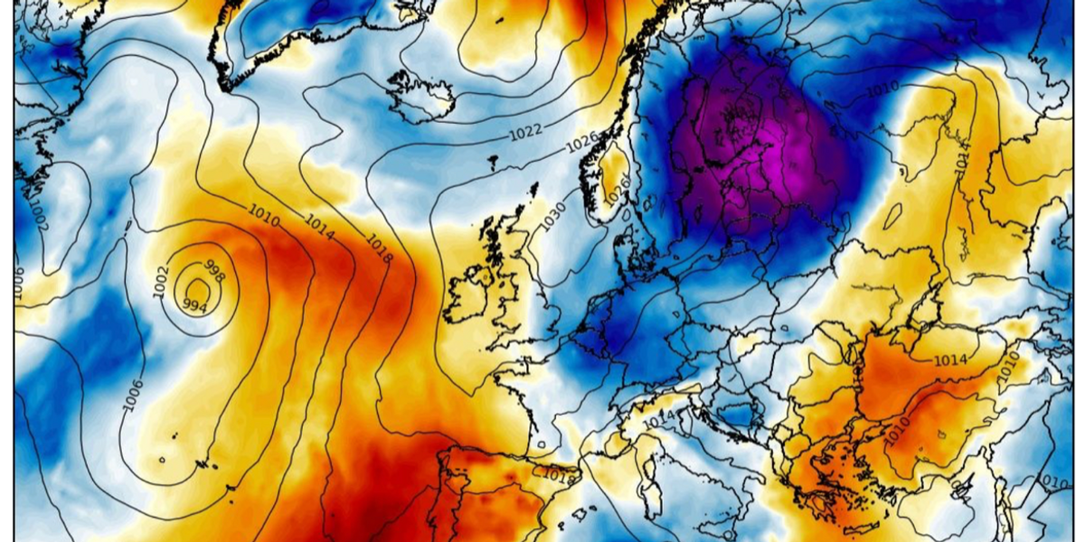
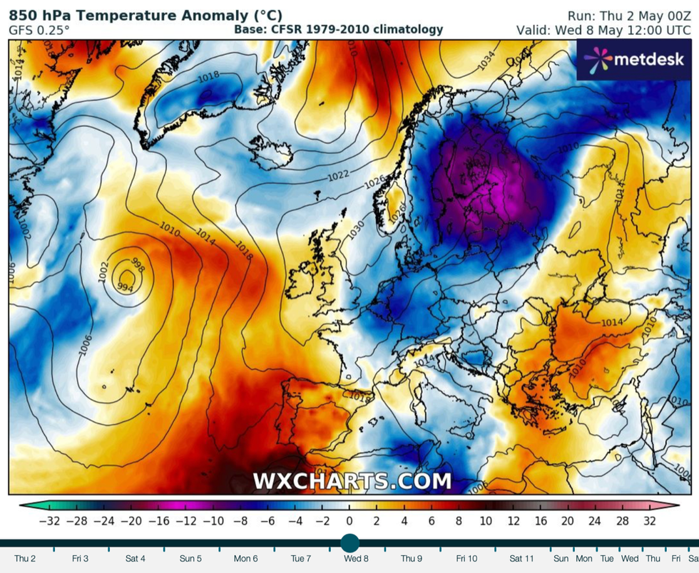
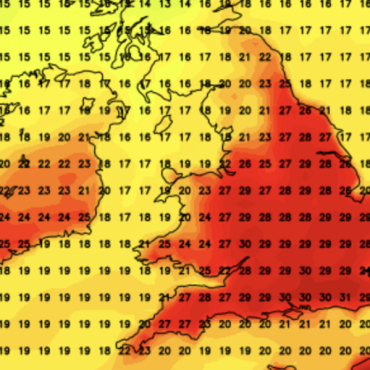
WXCharts
Met Office meteorologist Alex Deakin said: “It is unusual to see this level of low confidence in the forecast in a reasonably short time frame ahead, so it is giving us a few headaches.
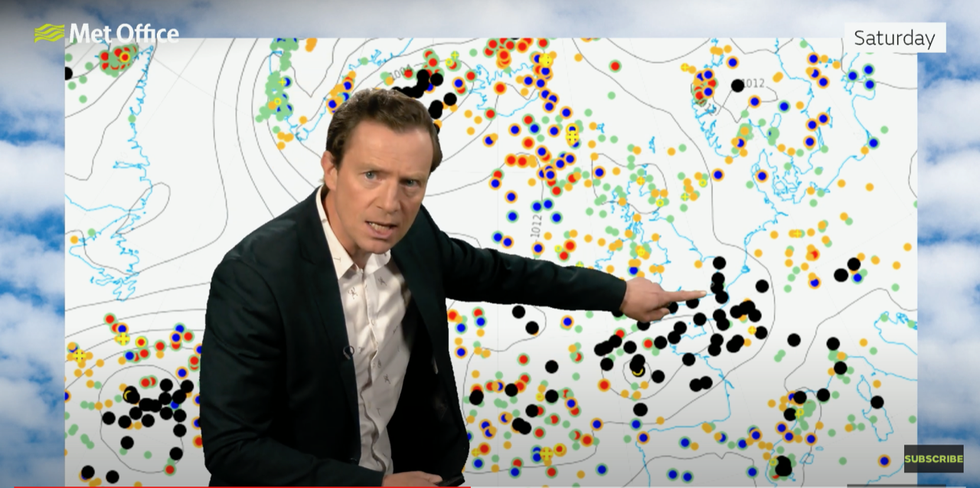
“Because the jet stream is weak, some of the computer models are struggling to identify exactly where that low pressure will be, and there is a lot of uncertainty about the weekend.
“The bank holiday is likely to be mixed, there is likely to be some rain, but it is not going to rain everywhere and when the sun is shining it is likely to feel quite warm.”
After months of storms, the jet stream–the main driver–is beginning to lose its clout allowing higher pressure to fend off the unsettled lows.
However, a ‘potent’ feature skirting the south coast over the coming days threatens further unsettled weather.
High pressure will build through the start of May, although depending on where it anchors, Britain will either be warm or cool.
LATEST DEVELOPMENTS:

Met Office’s Alex Deakin shows variance in computer models as to where weather systems will move over the weekend
Met Office
Mr Deakin said: “A low to the southwest is being pushed along by a reasonably weak jet stream as we head towards Saturday and Sunday and probably into Monday, and it looks reasonably potent with quite a few isobars around it.
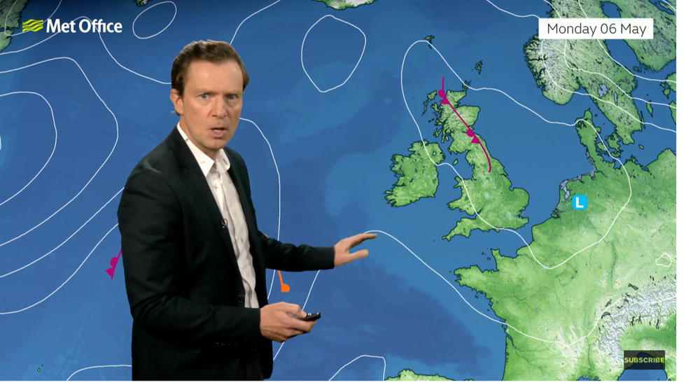
“By the time we get to Monday, the pressure patterns are how we describe as flabby, where there are not many isobars around but generally with low pressure dominating so there are likely to be showers.
“High pressure of some form is likely to move in during the second half of next week and probably dominate through the following weekend as well.
“If the high is sitting out to the west that will generate some northerly winds in, if is to the east it will generate southerly winds and that will dictate the feel of the weather.”
It comes after and explosive end to the week saw torrential downpours and thunderstorms hit southern Britain.
A plume of warm air from the Continent sparked an eruption of thunder and lightning on Thursday morning.

Met Office’s Alex Deakin shows high pressure creeping in next week
Met Office
And after a miserable end to last month, official figures revealed April to be the warmest for four years.
Unusually high temperatures at the start of the month pushed the average to 0.4C above the norm, according to the Met Office.
Britain’s weather could be about to take a U-turn as hopes grow for a sizzling run into summer.
Jim Dale, meteorologist for British Weather Services and social commentator, said: “There is no reason that May couldn’t deliver, especially after the very stormy last few months and disappointing end to April.
“The weather is often about balance, and this balancing effect could bring a sea-change as we go into the last month of spring.
“The synoptics will need to be in our favour for this to happen, and this is what failed to come about in the end during the last month.”






Post comments (0)