Sub-zero temperatures are set to plunge Britain into freezing conditions within 10 days, as a “disruptive” cold weather front strikes next week.
There are currently Met Office yellow weather warnings in place for Scotland due to heavy rainfall tonight and tomorrow with the national wether service giving notice that there is change of flooding and travel disruption.
But the current mild temperatures and wet conditions are set to disappear by next week as a low-pressure weather system moves in, bringing with it a chance of snow.
NetWeather’s Ian Simpson said: “On Tuesday and Wednesday, the rain over northern Scotland will slowly push southwards through the rest of the country, with colder, brighter weather pushing in behind from the northwest.
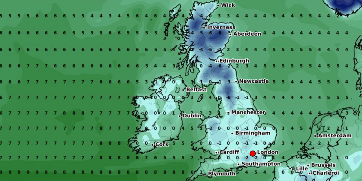
 Sub-zero temperatures will spread across the UK on February 12WX CHARTS
“There will be some wintry showers in northern Scotland.
“The main potential for disruptive weather sets in towards next weekend.
“Fronts will push in from the south-west on Thursday, introducing rain and milder air to England and Wales, and this is likely to result in some significant rainfall totals across a region of England and Wales, most likely the Midlands, northern England and north Wales, which could lead to some problems with flooding.”
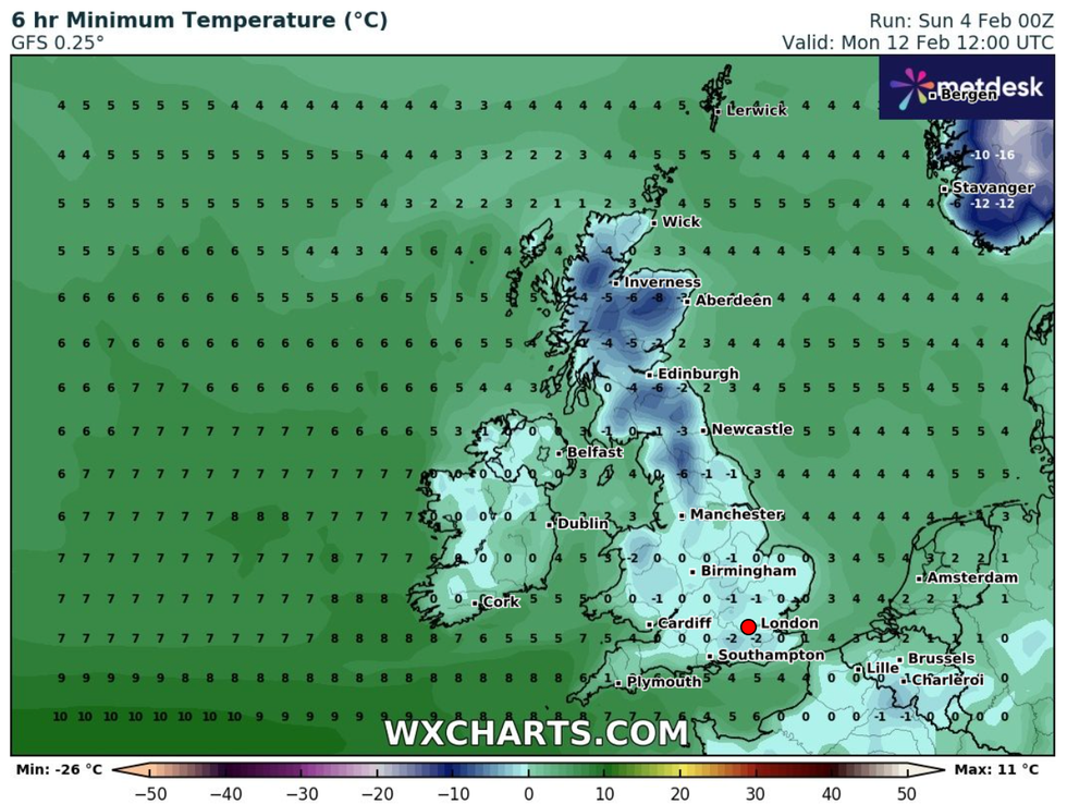
By Monday 12, weather maps from WX Charts indicate must of Britain will be experiencing temperatures of zero and below.

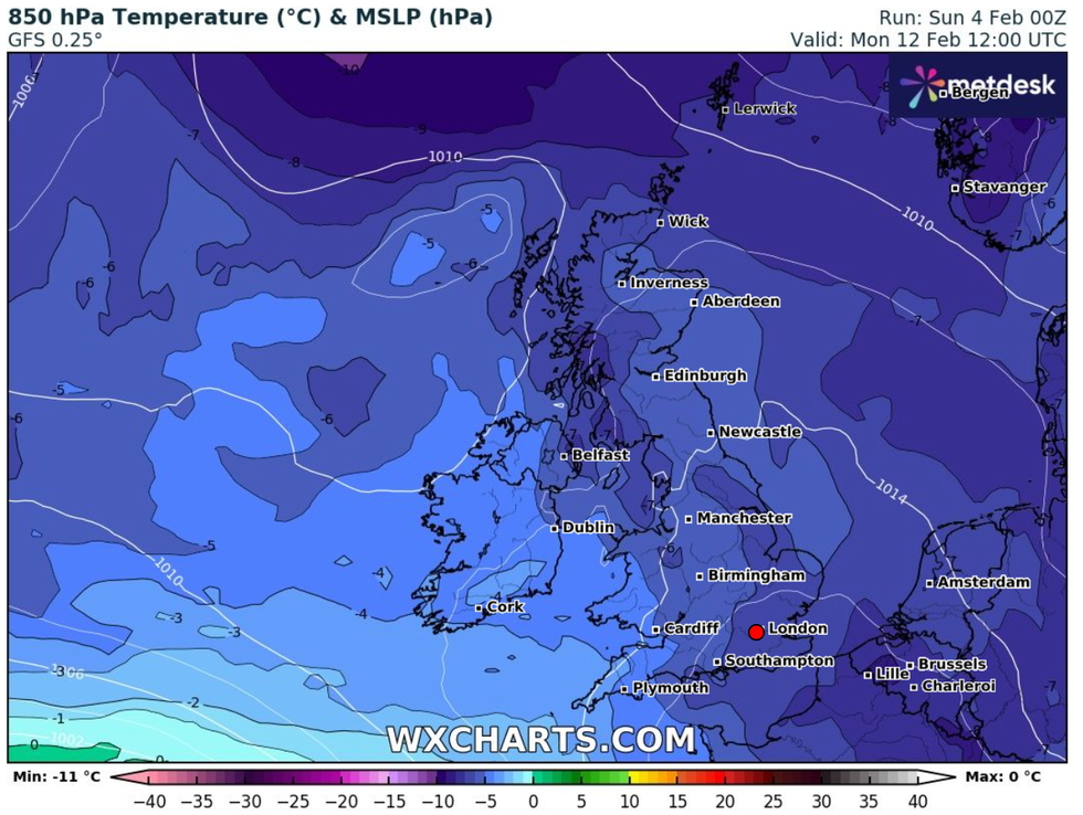
The cold weather will spread due to low pressure next weekend
WX CHARTS
The cold conditions will also increase the risk of snow across the country.
“As colder air pushes in from the north through Friday and Saturday, there is potential for this to turn to snow on the northern flank, mainly on high ground, but potentially to low levels as well, depending on how quickly the cold air comes down from the north,” Simpson added.
“There is potential for the rain to reach Northern Ireland, but probably only the south of the region.
“For Scotland, it looks set to remain cold and bright, with an increasing chance of snow showers in the north and east of Scotland.”
The Met Office has also forecast snow following next weekend as the cold front moves across the UK.
Its long range forecast states: “Through the weekend a change toward a north or north-westerly wind brings cold conditions spreading across the UK with wintry showers across coasts by Sunday but clearer inland as rain clears southeast.”
But it does not anticipate the cold weather lasting long, adding: “A further change expected mid-week as high pressure becomes increasingly dominant.
“Temperatures potentially recovering to average with this, though any prolonged clear skies liable to bring localised frosts and fog risk.”


 Sub-zero temperatures will spread across the UK on February 12WX CHARTS


Post comments (0)