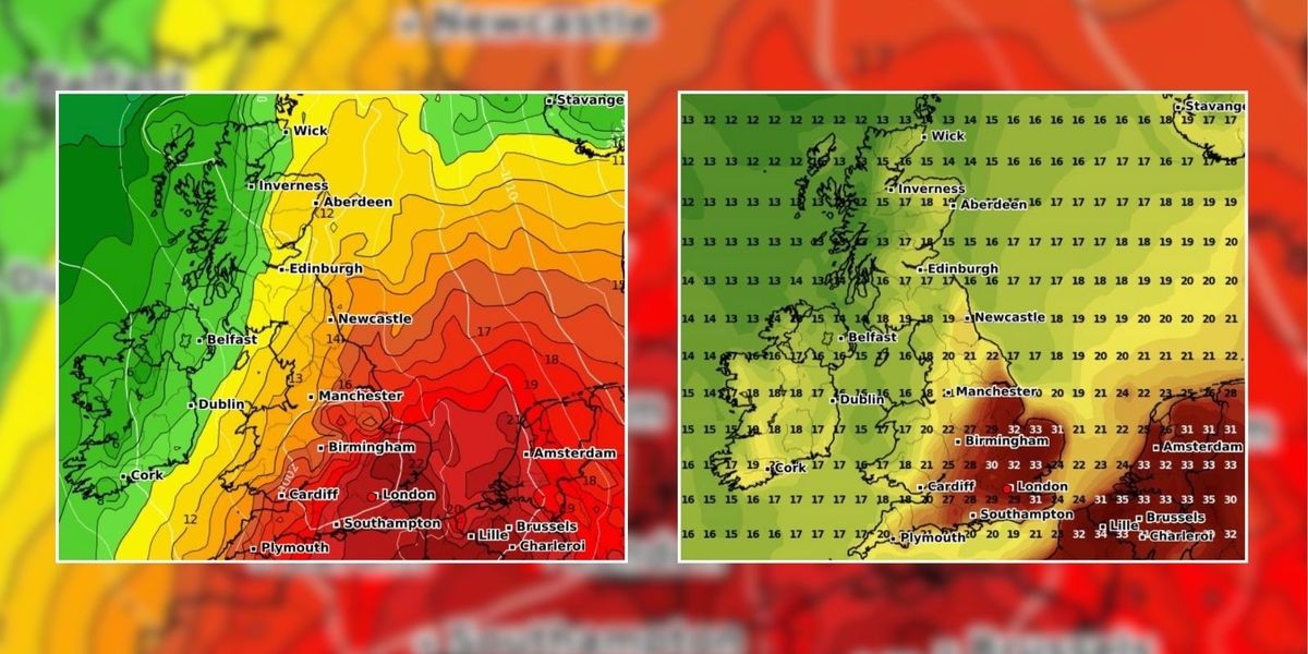
Britain is set to bask in glorious sunshine this weekend and into Monday as temperatures are expected to skyrocket to 33C.
A short-lived spell of very hot weather is forecast to strike from Saturday until Monday for much of England and Wales.
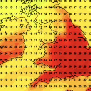
The latest weather maps suggest that temperatures of 33C to 35C could hit areas of south east England and East Anglia by Monday.
Senior Meteorologist and Social Commentator, Jim Dale told GB News that this weekend could see the hottest day of the year so far.
 Britain is set to bask in glorious sunshine this weekend as temperatures are expected to sky rocket to 33CWXCHARTS
He said: “There is a long-distance association to ex-hurricane Debby with this particular heatwave, and she will positioned off the US northeastern seaboard by Monday.
“That will help to embolden the Spanish plume on our side of the Atlantic that will bring the searing heat to us with the peak expected then; though it’s fair to say 80 per cent of Europe will be enduring sweltering conditions at this time.
“This will be the 6th or 7th time we will have seen temperatures push past 30C in the UK this summer.
“And although we were on the fringes of the big heat for the first couple of months, those who say we haven’t had a summer are living in cloud cuckoo land!”
LATEST DEVELOPMENTS:

The latest weather maps suggest that temperatures of 33 to 35C could hit areas of south east England and East Anglia by Monday
WXCHARTS
While southern parts of the UK will experience hot conditions, northwestern parts will see heavy downpours.
Dale added: “Increasingly warm or very hot weather is expected from Saturday to Monday for most of England and Wales, with 33C to 34C set for south east England and East Anglia by Monday.
“Hottest day of the year likely, while the north west of the UK comes to suffer some torrential rain. Worlds apart!”
The latest weather maps suggest that Monday will see the highest temperatures – with 32C set to hit Greater London and suburban towns.

A short-lived spell of very hot weather is forecast to strike from Saturday until Monday for much of England and Wales
WXCHARTS
Netweather’s forecast says: “This period will see mainly westerly winds and the jet stream pushing further south, but despite this, it looks likely to frequently be dry and warm in East Anglia and south-east England, particularly early in the week.
“There will be some very hot weather at times over France and Spain which means that there is potential for one or two individual very hot days towards the south east, associated with southerly winds, and potentially some thunderstorms when the heat breaks down.
“There is potential for August 12, in particular, to be a very hot day in the south east, although it is ‘touch and go’ as to whether the very hot air mass over France that day will make it into the south east of England.”


 Britain is set to bask in glorious sunshine this weekend as temperatures are expected to sky rocket to 33CWXCHARTS


Post comments (0)