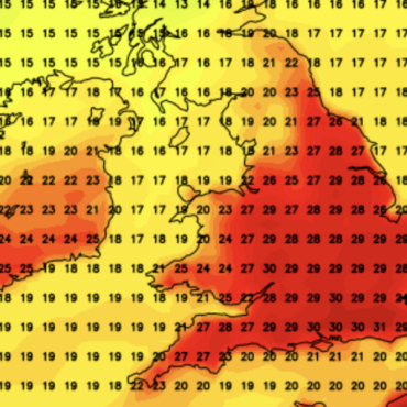
A 10-day ‘Bermuda High’ heat blast is about to push temperatures towards 30C prompting a government ‘significant impacts’ warning.
A dramatic U-turn from this weekend threatens to plunge Britain into the first ‘heatwave’ of summer.
Tropical warmth will flood in from the Continent, driven by high pressure and an ‘amplified’ jet stream.
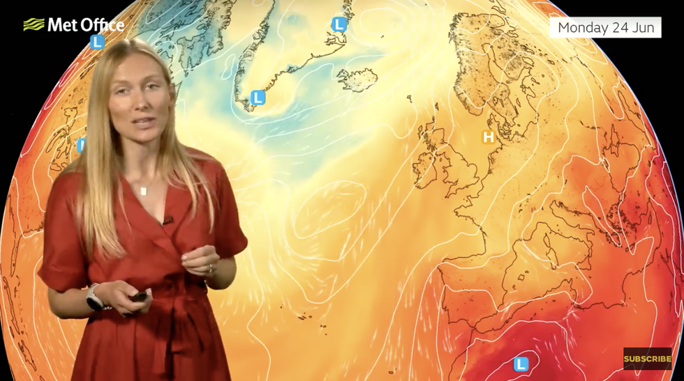
Met Office meteorologist Annie Shuttleworth said: “The jet stream with a strong jet core is going to push up to the north of the UK as the weekend progresses ,and that will allow this high pressure to the south to build.

PA
“As the jet stream amplifies to the north of the UK, that will allow heat to build from the south, particularly across the southwest at first but that heat builds more widely towards next week.
“We are quite confident that it is going to stay warmer than average for at least the next 10 days.”
High pressure from the Azores –the Azores or ‘Bermuda’ High–is likely to extend across Britain later next week.
This would bring warm air up from the Continent, where temperatures in parts are hitting 35C.
Although experts are confident warm weather will hold out through the rest of June, low pressure, and rain, could creep back.
Ms Shuttleworth said: “The high pressure is likely to shift a little bit further east of the UK, and that will allow the winds to move in from a more of a continental direction and that is why temperatures will start to rise through the beginning part of next week.
“The most likely situation is that high pressure is still centred out to the southwest, and that is the Azores high which is likely to stay to the south and the west throughout next week.
“That is currently the most likely scenario.”
LATEST DEVELOPMENTS:

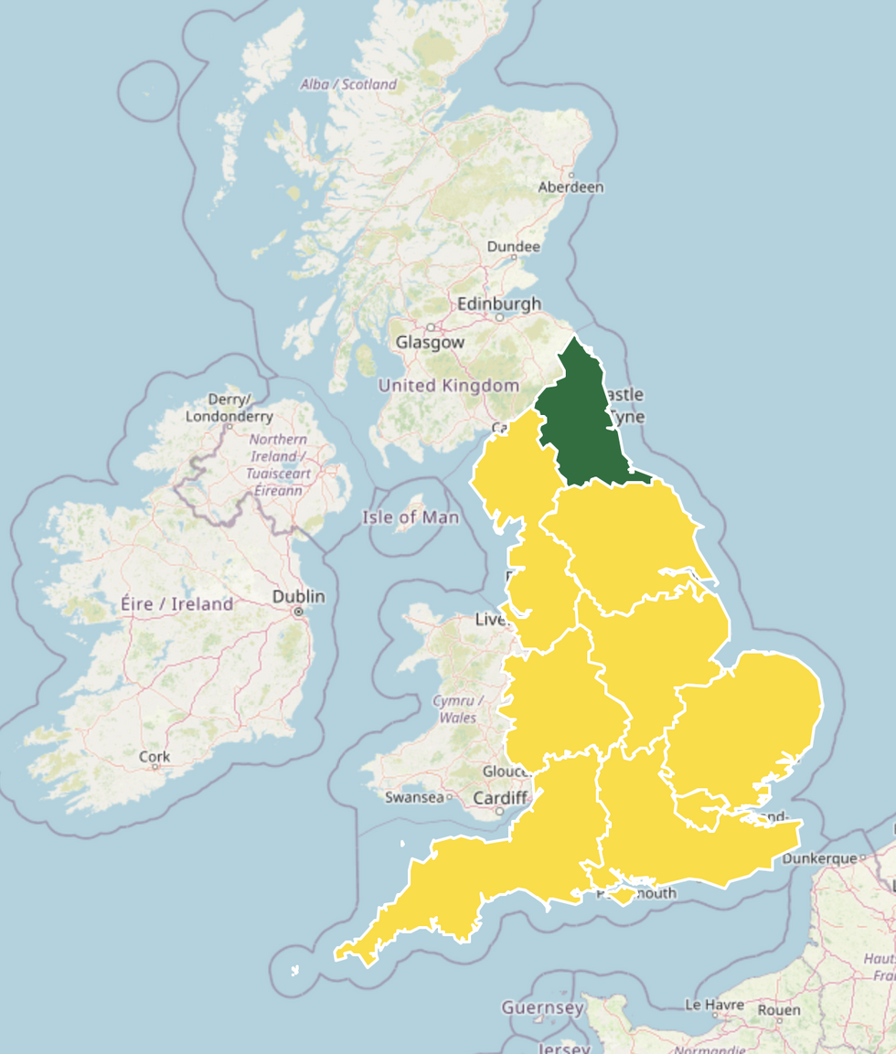
Yellow heat health alert in force
UK Health Security Agency
As thermometers rise, health authorities have raised the alarm for potentially dangerous heat.
The definition of a heatwave is for temperatures to remain above threshold levels for three or more days.
The UK Health Security Agency (UKHSA) has issued a yellow ‘level-1’ heat health watch through next week.
A spokesman said: “There is potential for significant impacts to be observed across the health and social care sector due to the high temperatures.”
The warning will remain in force between Monday and Thursday with the elderly and those with health conditions most at risk.
However, for many, this weekend will mark the start of a long-awaited summer blast and the end of weeks of chilly temperatures and rain.
Despite Met Office statistics recording the hottest spring on record, sunshine and warmth have been in short supply since the start of June.

Met Office’s Annie Shuttleworth describes how high pressure will bring heat in from the south
Met Office
Jim Dale, meteorologist for British Weather Services and social commentator, said: “As we go through the end of the month and into July, we will see high pressure start to become dominant.
“It will start to turn warmer, and humidity will rise as the Azores High comes in from the weekend.
“It is really going to start warming up from the end of June.”
Exacta Weather forecaster James Madden added: “It is likely we are going to see high pressure dominating with temperatures starting to rise significantly.
“This will pave the way for some possibly extreme hot weather during July.”
As the mercury rockets, bookies have slashed the odds on a late June scorcher with Coral offering 1-2 from 3-1 on 30C before the end of the month.
Spokesman John Hill said: “We have waited long enough for the mercury to rise, but our betting suggests we may still get sizzling 30C temperatures before the month is out.”






Post comments (0)