Americans heading away for Christmas face “back-to-back” storms amid warnings to prepare a “tornado action plan”.
Relentless bouts of wind and rain steered by an “atmospheric river” threaten festive mayhem for millions of holidaymakers.
A tornado that spun up in San Francisco over the weekend could be the first of several to strike through the coming days.
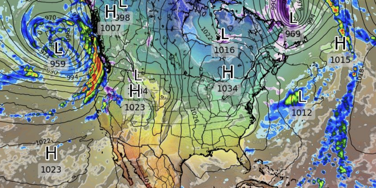
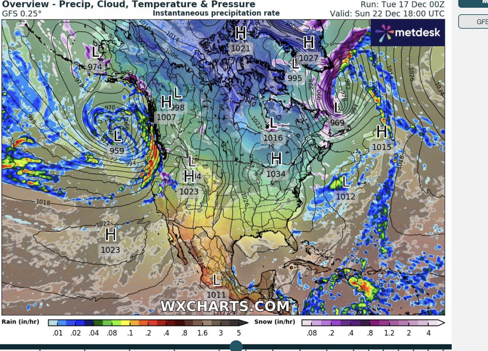
Meanwhile, a “conveyor belt” of storms barrelling across the country threatens damaging winds, floods and crippling snow.
 US weather: Americans face ‘back-to-back’ storms as Christmas chaos loomsWX Charts
Weather Channel meteorologist Rob Ellis said: “We are tracking a pair of systems that are going to move across the country and the colder air on the northern side of these is going to bring the possibility of some wintry precipitation from the Great Lakes into parts of New England.
“By Wednesday, the northeast is expected to see some snow showers, and there is also the possibility of some icing, especially for the central Appalachians, and we are looking at southwestern parts of Pennsylvania and into west Virginia.”
Freezing temperatures could lay more than a tenth of an inch of ice in parts, he warned, while three inches of snow is possible across eastern states.
While parts of the country brace for snow, storms will be the threat across central and western regions.
US LATEST:
Tornadoes, though not unheard of at this time of year, are on the radar across California after a weekend twister hit the region toppling trees and throwing cars into the air.
Weather Channel spokesman Chris DeWeese said: “It was strong enough to overturn cars and topple trees, leaving several people injured and thousands without power.
“Although California tornadoes are uncommon, they aren’t exactly rare, with the Golden State typically experiencing an average of 11 twisters per year.
“This is a reminder that they can and do happen any time of the year, and that it’s always good to have a tornado safety plan ready to go.
“Back-to-back systems are on their way.”
We’ve made the ultimate Christmas Bundle for the biggest GB News fans! Whether you’re treating yourself, or organising a gift for another keen GB News viewer, this bundle is packed with bestselling products and exciting new exclusives. Order today and recieve free UK shipping, with delivery before Christmas Day
GBN Christmas Bundle
£102.42
£69.99

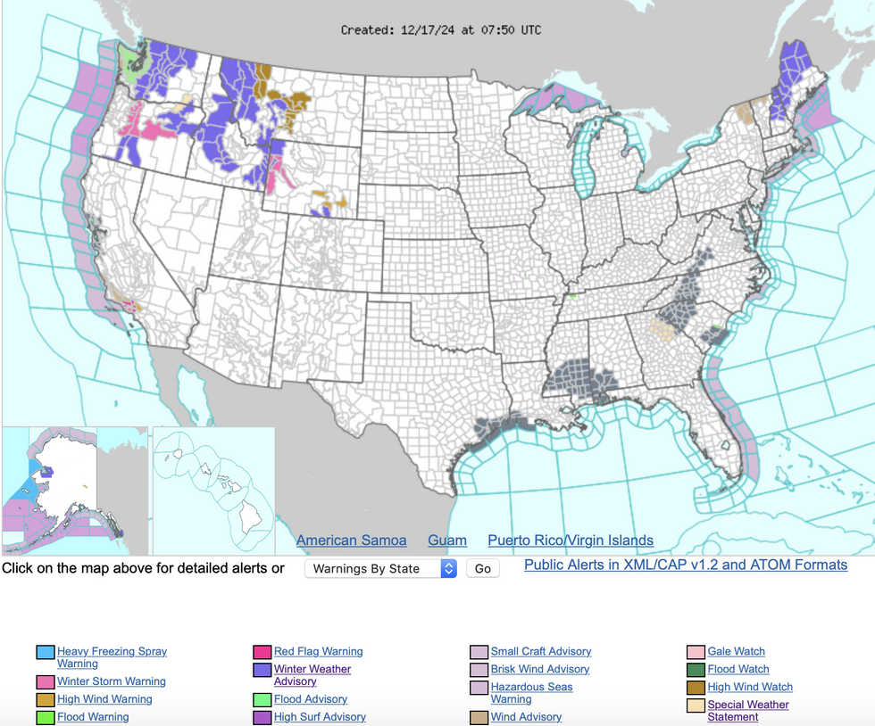
Weather Service (NOAA) alerts in force
NOAA
Once again, the driver of disruptive weather is an atmospheric river charging in from the Pacific.
The bands of moisture are carried at speed into the western coast before hitting land and dumping their load.
Atmospheric rivers bring torrential rainfall and strong winds, helped by the jet stream on its easterly path.
Jim Dale, US meteorologist for British Weather Services and co-author of ‘Surviving Extreme Weather’, said: “There are two more storms on the way through the rest of the week coming in on a conveyor belt.
“Lows will be coming in through to the end of the week, with the risk of snow over the Great Lakes ahead of the weekend.”
The US National Weather Service has winter weather warnings in force across the northwest and the far northeast.
Separate alerts for strong winds cover Montana, Wyoming and Nebraska with winds tumbling over mountains strengthening by ‘lee cyclogenesis’.
A NOAA spokesman said: “Yet another Pacific system will help usher a wave of Pacific moisture, an atmospheric river, into the Pacific Northwest and inland over the northern Great Basin and the Rockies.
“Another more potent wave will approach from the west during the day Wednesday leading to lee cyclogenesis over the northern High Plains and helping to consolidate/strengthen a surface frontal system.
“Elsewhere, persistent shower and thunderstorm chances will continue for Florida, particularly along the Atlantic Coast, and some intense downpours are possible.”


 US weather: Americans face ‘back-to-back’ storms as Christmas chaos loomsWX Charts


Post comments (0)