The US hurricane season is about to roar back with three tropical storms possible in the run up to Christmas.
As the nation reels from devastation left by Hurricanes Helene and Milton, experts warn of ripples in the Atlantic basin.
Unusually warm ocean waters could push the hurricane season beyond its natural end in December, they warn.
A looping weather front straddling the mid-Atlantic may the trigger the next assault as soon as early November.

The first storm could hit in early November
AccuWeather
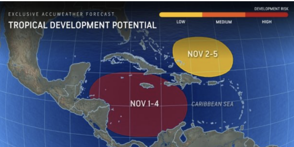
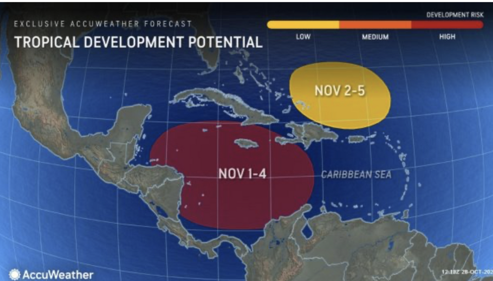
AccuWeather meteorologist Alex DaSilva said: “We’re already seeing early signs of showers and thunderstorms developing in the southern Caribbean.
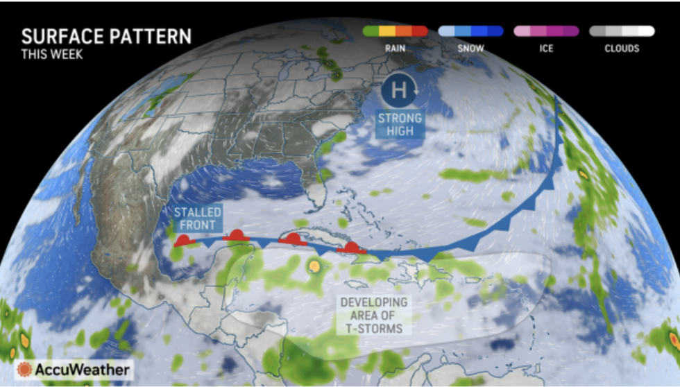
“As the area of high pressure builds to the north, it’s going to create a favourable environment for intensification.
“This could lead to a tropical storm or even a hurricane in the first few days of November.
“We are forecasting one to three named storms in the Atlantic basin next month.”
Despite the peaceful start to the hurricane season and the recent calm, Americans are warned not to ignore the growing danger.
The summer heatwave and an El Nino warming of the eastern Pacific has boosted surface temperatures around coastal waters and the Gulf of Mexico.
A ‘late-season surge’ could, contrary to form, unleash a powerful whopper during the festive season.
LATEST DEVELOPMENTS:

A storm could arrive as soon as this week with a disturbance spotted off the Caribbean coast, with ‘Patty’ to be followed by ‘Rafael’ and ‘Sara’
AccuWeather
Mr DaSilva said: “We’ve been saying since March that the end of this year’s hurricane season could be quite active.
“We’re expecting a late-season surge in the month of November with another one to three named storms possible in the Atlantic basin.
“We may even see a tropical storm in December this year, and although it doesn’t happen very often, the very warm sea surface temperatures could make it possible.”
A storm could arrive as soon as this week with a disturbance spotted off the Caribbean coast, with ‘Patty’ to be followed by ‘Rafael’ and ‘Sara’.
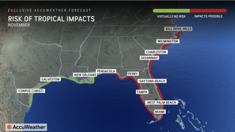
Meteorologists have issued a stark warning to officials for the start of November to be on alert for ‘topical impacts’.
AccuWeather meteorologist Bernie Rayno said: “We’re becoming more confident that the next named storm in the Atlantic basin could form within the next week.
“There is a large area of high pressure building across the northeast that has sent a stalled front southward.

Meteorologists have issued a stark warning to officials for the start of November to be on alert for ‘topical impacts’
AccuWeather
“That sets off a chain reaction that begins with showers and thunderstorms in the southern Caribbean.”
Meanwhile, trick or treaters are warming up for a terrifyingly hot Halloween with thermometers in parts to hit 80F.
Northeastern States will get the highest temperatures as a plume of warmth sweeps up from the south.
Weather Channel meteorologist Caitlin Kaiser said: “High temperatures could top Halloween records in dozens of Northeast cities, including Albany, New York, Hartford, Connecticut, and Trenton, New Jersey.
“The Southeast will see above-average warmth as well.”
Jim Dale, US meteorologist for British Weather Services and co-author of ‘Surviving Extreme Weather’, said: “Parts of the country will see unusually high temperatures this week in what is going to be a classic Indian Summer rather than chilly Halloween.
“In terms of temperatures, there could even be some records broken.”






Post comments (0)