Britain is bracing for a hot weather surge, with forecasts showing the temperatures could climb to 34C in the coming days.
Weather projections reveal a significant shift from the recent cooler conditions that marked the end of July.
The southeastern regions and East Midlands are expected to bear the brunt of the sweltering conditions.
Some areas could experience temperatures reaching 34C during this period.
The heat surge represents a stark contrast to current conditions and could meet the criteria for an official heatwave declaration.
The warming trend is anticipated to affect most of the UK, though regional variations will be significant.
LATEST DEVELOPMENTS:

METDESK
|
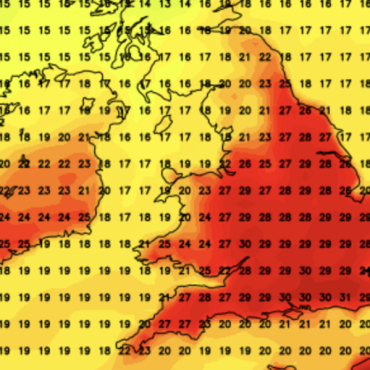
Forecasts show the temperatures could climb to 34C in the coming days
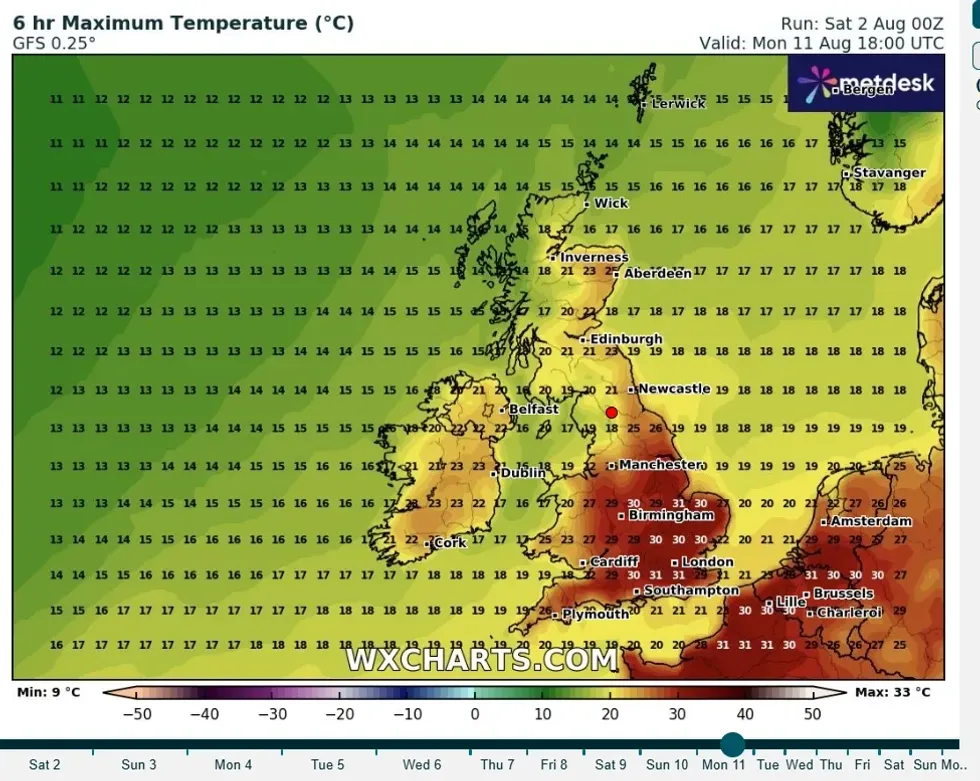
The anticipated heat surge will begin on August 11, with southern and eastern England experiencing temperatures in the upper twenties.
Kent and Essex could see the thermometer reach 31C, whilst Wales may experience highs of 27C.
Scotland and Northern Ireland will remain notably cooler, with temperatures predominantly staying in the teenage range.
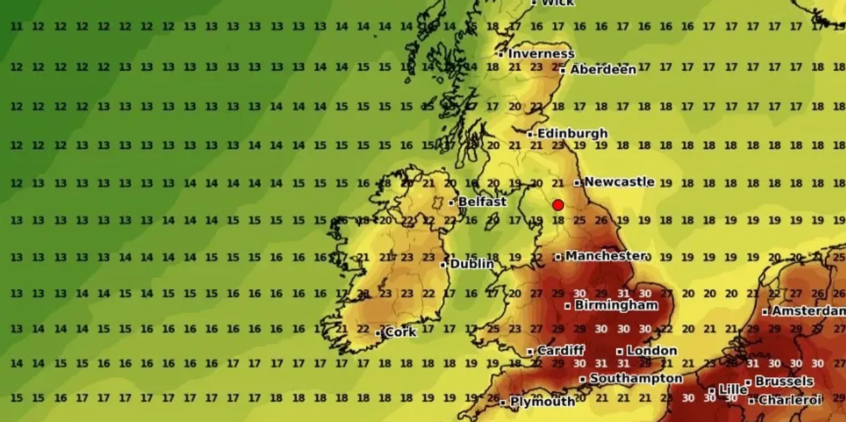
By August 12, conditions will intensify across England, with southeastern regions and the East Midlands potentially reaching 33C.

METDESK
|
Britain is bracing for a hot weather surge
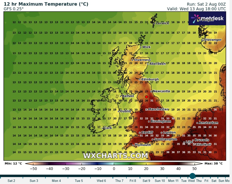
The peak is expected on August 13, when weather charts indicate widespread temperatures exceeding 30C across southern England and the Midlands.
Essex and eastern Hertfordshire may endure the most extreme conditions, with forecasts suggesting 33C.
Wales could also reach the 30C mark, whilst Scotland, including Edinburgh, should see more moderate temperatures in the mid-twenties.
 PA | A heatwave is declared when a location has to hit or exceed 25C in the west and north and 28C in London for three consecutive days
Northern Ireland is forecast to experience temperatures up to 24C during the peak period.
The heat is expected to persist through August 14, with southeastern and eastern England continuing to see the highest temperatures at 34C.
By August 15, temperatures should begin to moderate, though southern England will likely remain warm with highs around 31C.
The Met Office’s extended forecast suggests that “an increased chance of high pressure becoming more dominant” will bring “drier, warmer and more settled conditions” becoming more prevalent during mid-August.
 GETTY |
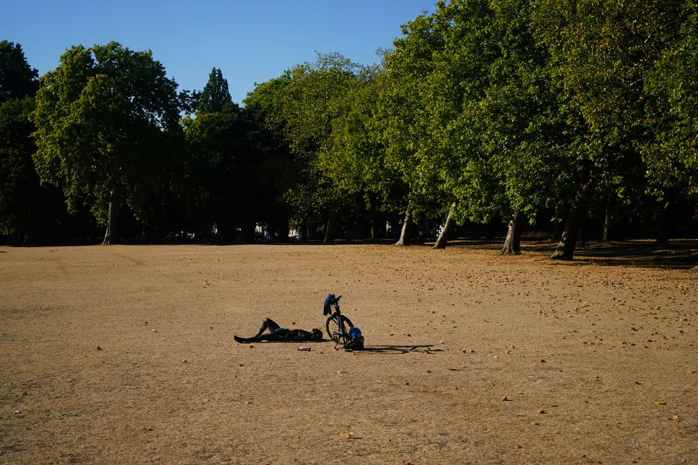
The northwest may see more in the way of occasional rain or showers than other areas
The forecasters indicate that “high pressure, and therefore fairly settled conditions overall, appears most likely for the second half of August.”
The northwest may see more in the way of occasional rain or showers than other areas.”
In the UK, heatwave declarations require three consecutive days of temperatures meeting or exceeding regional thresholds.
For most of southern England, this benchmark stands at 27C to 28C.


Post comments (0)