A battle between the Arctic and Atlantic will turn Britain into a 10-day combat zone of freezing gales, snow and storms.
As the nation braces for the first winter downpours of the season, experts predict a smorgasbord of freakish weather into the Festive season.
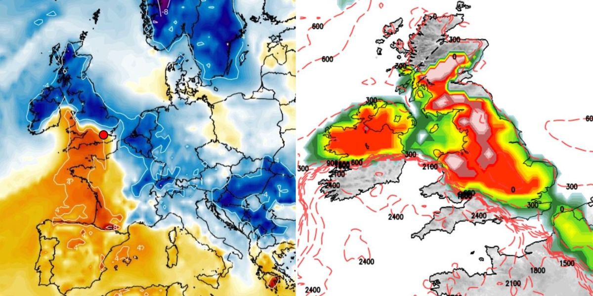
Polar winds through the coming days will send temperatures tumbling as swathes of the country braced for heavy snow.
Then, milder south-westerly winds will barge in from the Atlantic ahead of the weekend, possibly bringing heavier snow to parts.
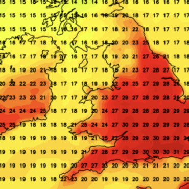
 A battle between the Arctic and Atlantic will turn Britain into a 10-day combat zone of freezing gales, snow and stormsNetweather/ WXCHARTS
Tussling northerly and southerly winds threaten yo-yoing temperatures into December as the nation braces for weeks of erratic weather.
James Madden, forecaster for Exacta Weather, said: “Towards the end of this week as unsettled and potentially stormy conditions clash with much colder air across the UK, we could see another transient and widespread snow event.
“Beyond this first widespread snow event, we will see wintry precipitation and snow showers continuing sporadically across the country throughout the working week with a snow shower or two possible anywhere.
“We could see some more prominent snow showers continuing across the north, and western and eastern coastal areas, particularly across Wales.”
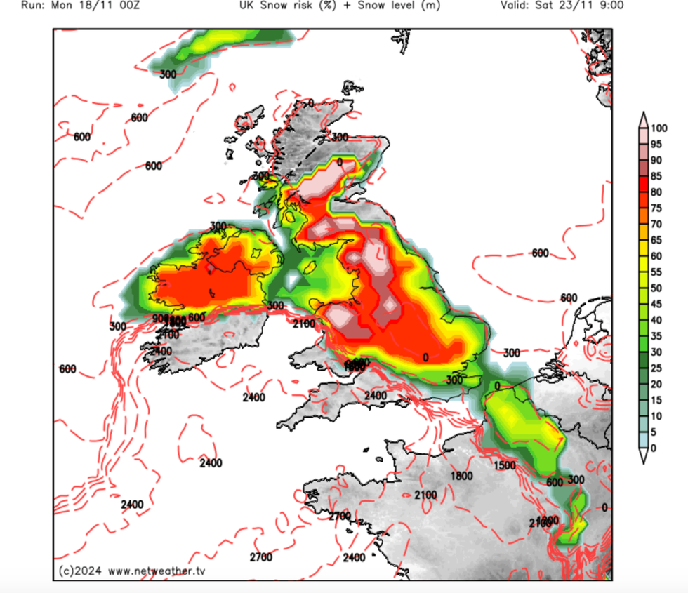
The warning comes as Britain takes cover for the first proper winter spell of the season, with up to four inches of snow forecast in parts.
Government warnings have been issued through the start of this week for disruptive winter conditions.

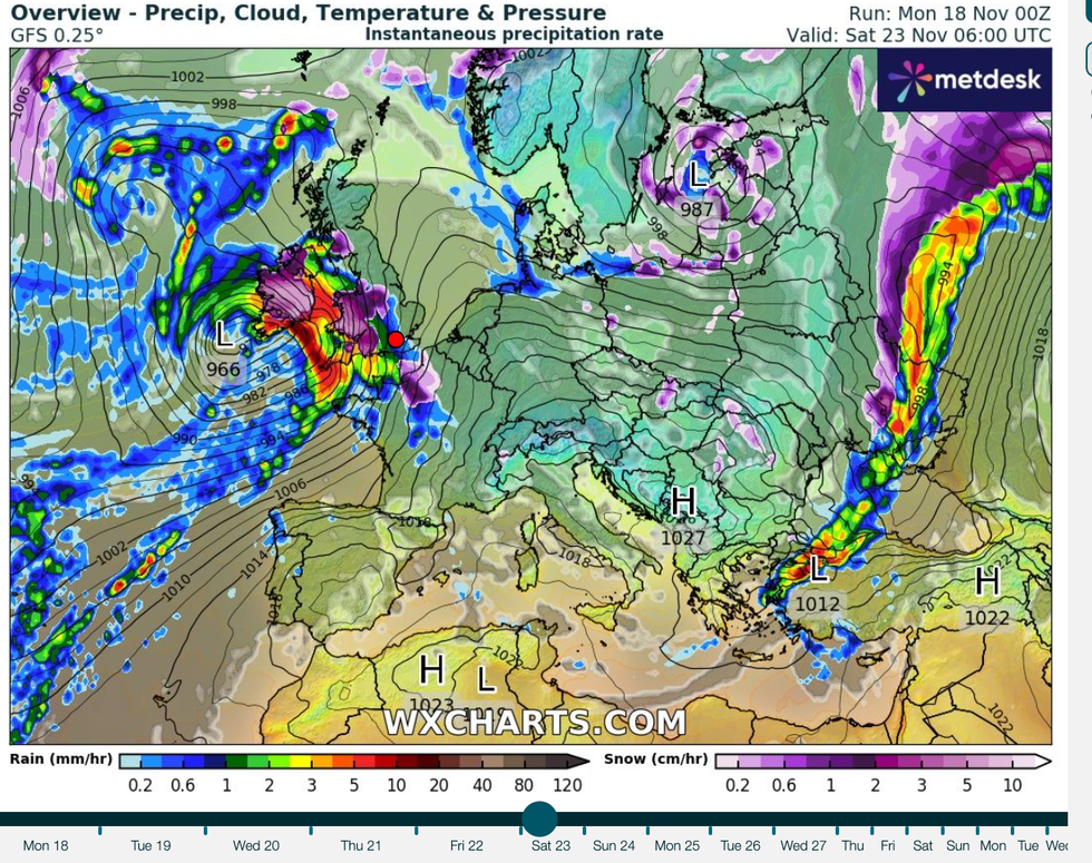
Tussling northerly and southerly winds threaten yo-yoing temperatures into December as the nation braces for weeks of erratic weather
WXCHARTS
Atlantic pressures system crossing Britain will bring wetter, windier conditions to southern regions while the north stays locked in the freezer.
However, meteorologists admit scuffling weather systems coming from all directions are causing a forecasting nightmare.
Met Office meteorologist Aidan McGivern said: “The main uncertainty is what happens with these Atlantic lows that contain milder airs and wetter conditions.
“One plausible scenario is that these lows stay away and we keep the cold northerly winds with wintry showers around the coasts with some more prolonged wintry weather coming through and weather fronts from the north but many places crisp and clear.
“Another outcome is for these lows to approach from the south, bringing spells of rain, and then bumping into the cold air and in between, somewhere across the UK likely to see some more prolonged snow.

The warning comes as Britain takes cover for the first proper winter spell of the season, with up to four inches of snow forecast in parts
Netweather
“A slightly less likely outcome, but still possible, is for these lows to make more progress across the UK bringing more widespread wind and rain and bringing that mild air to most of the UK, ending up milder than average, wetter and windier.”
As the first snow of the season falls, however, experts have warned Britons to take extra care out and about.
The UK Health Security Agency has issued a Cold Weather Health Alert lasting until the end of the week while motoring experts have warned of icy roads.
Plunging temperatures have also prompted bookies to slash the odds on the coldest November on record.
Ladbrokes spokeswoman Nicola McGeady said: “The odds are falling faster than the temperatures on this month going down as the coldest November ever.”


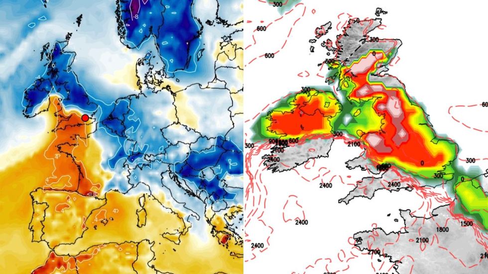 A battle between the Arctic and Atlantic will turn Britain into a 10-day combat zone of freezing gales, snow and stormsNetweather/ WXCHARTS




Post comments (0)