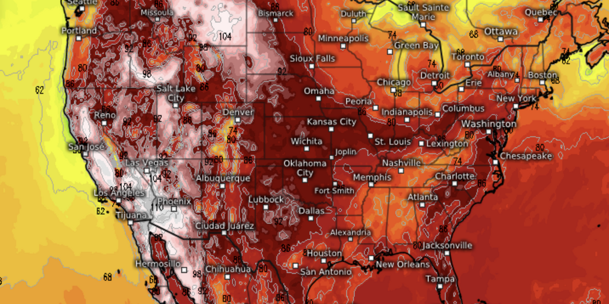
A searing heat dome will stay anchored over the United States for another month with ‘dangerous’ temperatures forecast through August.
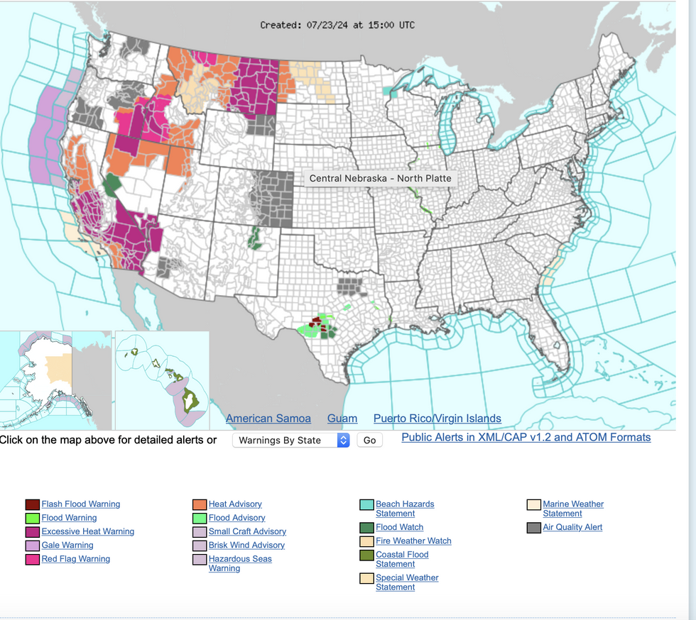
Thousands of miles of western America have been issued fresh government warnings for extreme heat and wildfires.
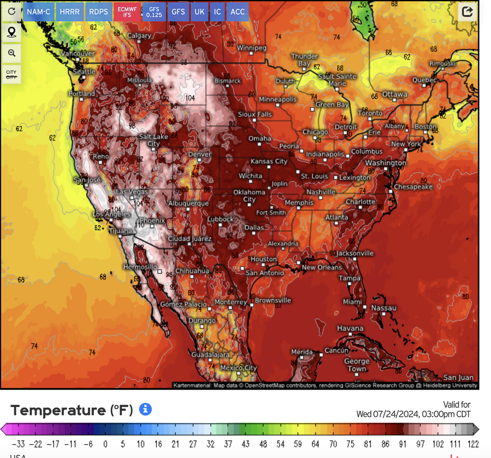
Temperatures in six states will rocket to 110F (43.3C) through the coming days with bone-dry winds turning parched ground into fire-ready kindling.
Unbearable heat will continue through the rest of summer in parts of the country, according to long-range forecasters.
 Searing heat dome to anchor ‘dangerous’ 43C hot blasts through AugustWeather.US
AccuWeather lead long-range expert Paul Pastelok said: “We expect the summer heat to stick around right through August for people in central California, eastern Oregon, and most of Nevada and Idaho.
“The stubborn area of high pressure responsible for it will continue to bake these areas, drying out vegetation and likely setting new record temperatures in the coming weeks.”
Residents are urged to prepare for extreme summer weather as soaring temperatures increase the risk of heat-related illness.
Pastelok said: “People dealing with the intense heat in the West are urged to stay hydrated, wear loose and light-coloured clothing, and take frequent breaks in the shade or air-conditioned areas to avoid heat exhaustion or heat stroke.
“People who live, work, and are travelling through areas facing a ‘high’ risk of wildfires are urged to use caution outdoors to prevent any accidental sparks that could start a new wildfire.”
US WEATHER:
The National Weather Service (NOAA) warns heat this week will spread across western states.
Where hot, humid air meets cooler temperatures, unstable conditions will spark thunderstorms and torrential downpours.
Further east, cooler temperatures will provide an oasis from the oppressive conditions.
A NOAA spokesman said: “Major to locally extreme Heat Risk will expand across the northern High Plains as heat gradually becomes less intense over the Central Valley of California and the Great Basin.
“In contrast, cooler than normal temperatures will prevail across the mid-section of the country and into portions of the eastern US where a stalled front will keep plenty of clouds along with scattered thunderstorms.
“These thunderstorms are not expected to be potent, but they could result in localized flooding issues from time to time across the southern tier states and up and down the East Coast.”

NOAA wildfire/ heat warnings
NOAA
A storm system heading towards the west coast this week will bring further outbreaks of heavy rain, experts warn.
Thunderstorms and intense torrential downpours threaten flash flooding across the region.
Jim Dale, meteorologist for British Weather Services and co-author of ‘Surviving Extreme Weather’, said: “A low is coming into Washington, and this will spark off a few thunderstorms.
“There is likely to be a lot of rain in a short period of time and this will bring a risk of flooding to parts of the region.
“However, the heat is going to continue and there is no sign of a letup through the coming weeks and into August.”
A NOAA spokesman added: “Meanwhile, monsoonal thunderstorms will continue across the Great Basin and the Four Corners region with the threat of localized flash flooding for the next couple of days.”


 Searing heat dome to anchor ‘dangerous’ 43C hot blasts through AugustWeather.US


Post comments (0)