A rain-loaded ‘atmospheric river’ stalled over the west coast of America threatens further ‘dangerous’ flooding, landslides and heavy snow.
California faces a torrential deluge through the week as the state battles historic downpours which have left thousands without power and killed three people.
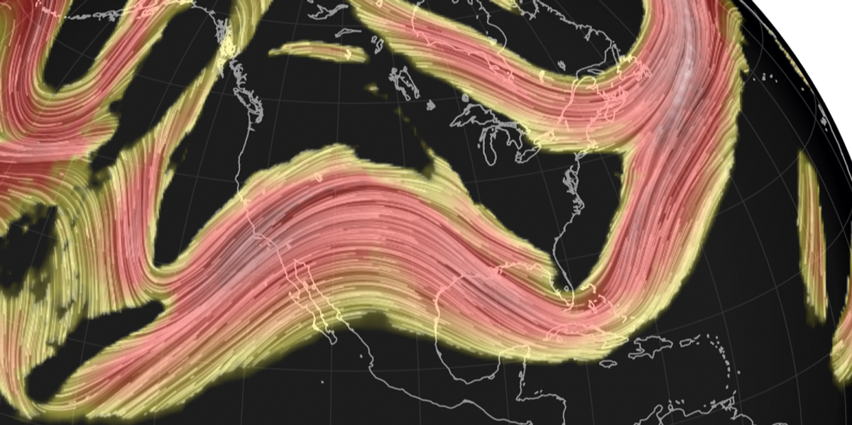
A ‘siege’ of low-pressure storm systems –known as a ‘pineapple express’–will sweep the west coast prompting fresh warnings from national weather officials.
California has this winter been the target for a series of atmospheric rivers – bands of moisture in the atmosphere carrying up to a tonne of rain.
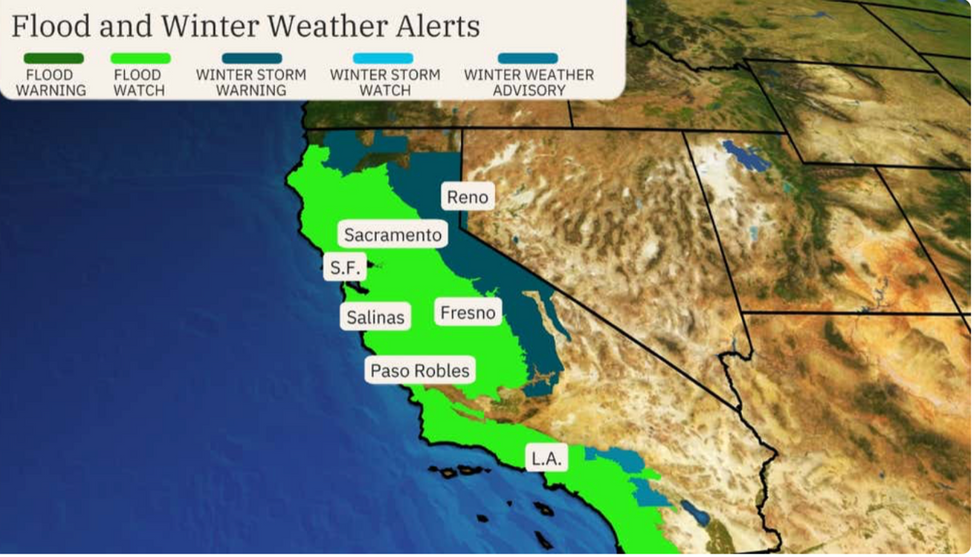
Fresh flood watches are this week in force across California, predominantly in San Francisco, Fresno, and Los Angeles.
Weather Channel meteorologist Linda Lam said: “A series of low-pressure systems will approach the west coast this week, and multiple atmospheric river events are possible which are going to increase flooding concerns.

Flood risk across California
THE WEATHER CHANNEL
“California is facing another multi-day siege of stormy weather for several days through mid-week, and this could result in flooding and landslides.
“Flooding and landslides will be a serious concern with the heavier rainfall totals. Remember to never drive through roadways covered with water.”
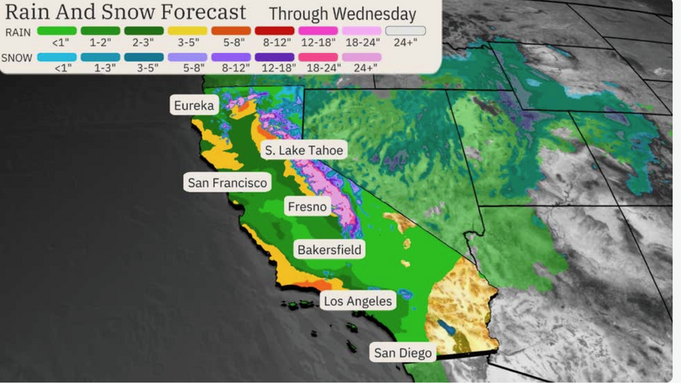
Northern California could see up to six inches of rain through mid-week, with central California expecting up to five inches while three inches hit southern regions.
Santa Barbara County is on alert for flooding and mudslides, although this will be a risk along the entire Californian coast.
Wind driving moisture over high ground will bring the added risk of mountain snow, Ms Lam added.
She said: “Heavy flooding rain, mountain snow, gusty winds and coastal flooding are expected.”

Midweek risk of rain and snow in California
THE WEATHER CHANNEL
California has been at the mercy of a spate of atmospheric river downpours since the start of winter.
The phenomena appear as long, thin channels of water high in the Pacific atmosphere which offload copious rain and snow when they hit land.
When they ‘stall’, they cause extreme rainfall events and increase the risk of mudslides and dangerous flood conditions.
A strong atmospheric river is often referred to as a ‘pineapple express’, an several have contributed to California’s woes this month.
A stalled ‘quasi-stationary’ front has been the driver of heavy rain since the weekend, according to the National Weather Service (NOAA).
It will this week bring the additional hazard of heavy snow, with up to two feet of snow possible over high ground, it warned.
A spokesperson said: “A quasi-stationary front will be the focus for additional heavy rainfall over southern California.
“Additional accumulations of six to twelve inches of snow are expected for the Sierra, while one to two feet are likely over the Shasta Siskiyous on Tuesday.
“This snowfall is likely to continue into Wednesday and expand in coverage into the Central Rockies.”
A strong ‘zonal’ jet stream, which describes the jet straightening and driving low pressure from the Atlantic, will boost the deluge.
Jim Dale, US weather correspondent and meteorologist for British Weather Services, said: “The Pacific northwest will see more disruptive rainfall, and this is in line with the zonal pattern that has driven the very wet weather in the region.
“There is going to be a lot of rain across California in the run up to the weekend.”


Post comments (0)