A monster storm supercharged by ‘rapid cyclogenesis’ threatens a devastating assault of floods, blizzards, ‘damaging’ tornados and even wildfires.
Storm Finn – the second in a trio of tempests gnashing their teeth at the United States – is due to smash the nation today.
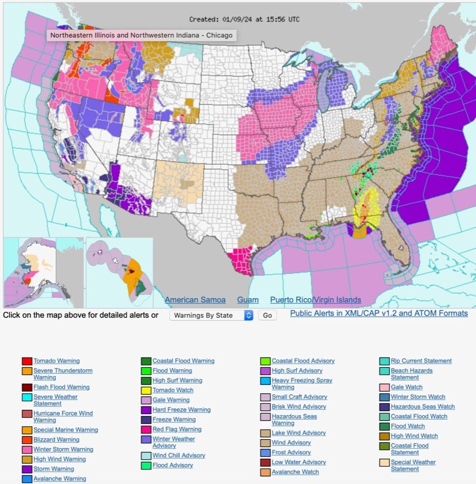
National weather advisors have issued a raft of warnings covering almost the entire country through the next 24 hours.
Furious winds will scour hundreds of miles of eastern America while winter storms, blizzards and thunderstorms threaten the west.

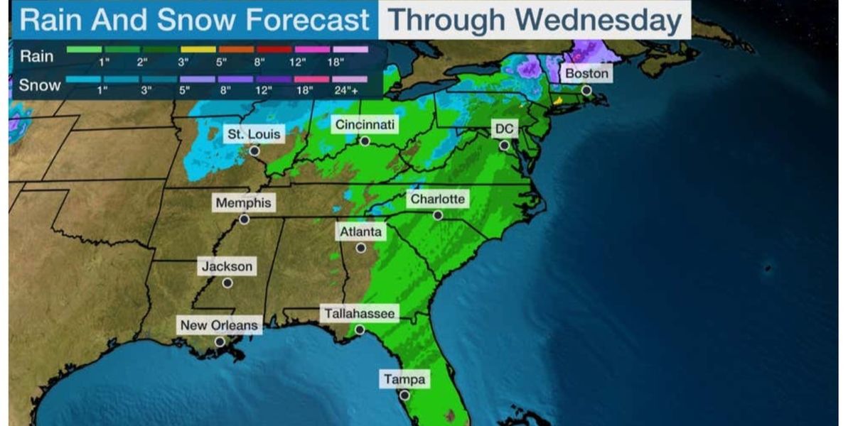
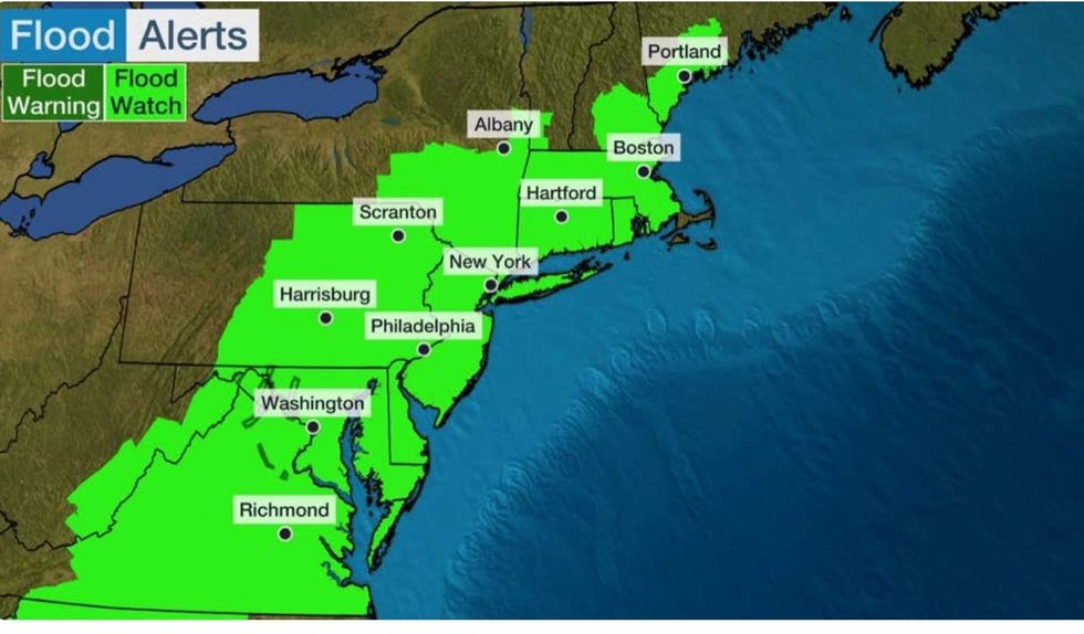
The east of the US will be affected by flooding
The Weather Channel
Georgia, Alabama and parts of Florida are on tornado watch, while southern Texas, dry winds have sparked warnings for wildfires.
The warnings come amid a three-storms attack – Ember struck after the weekend with impacts from Finn expected into midweek with the next, Gerri, close behind.
A spokesman for the National Weather Service (NOAA) said: “A major storm system will hammer the Eastern US with widespread heavy rain, strong winds.
“A very potent mid-upper level trough over the Central US is becoming negatively tilted and this is allowing for rapid surface cyclogenesis over the Midwest and Ohio Valley.
“Widespread hazardous weather impacts are expected for the eastern third of the US in association with this low-pressure system, and numerous warnings and advisories are now in effect from the local NWS forecast offices.”
A cold front will swipe north-eastern states through today adding a deluge of snow to the hellish onslaught.

The NOAA has issued a raft of warnings across the US
National Oceanic and Atmospheric Administration
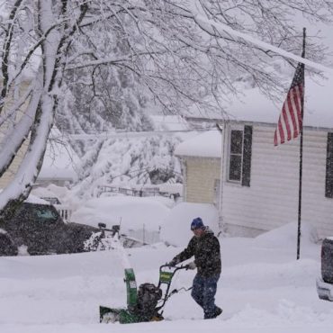
Up to three inches could blanket parts of New England, Wisconsin, Missouri, Iowa and Illinois.
Gusts of 60mph threaten to topple trees, damage homes and other buildings while knocking out power supplies.
Weather Channel meteorologist Domenica Davis said: “What a mess we have got.
“We are not just worried about the rain, but the snow melt, so we are looking at that flood threat where you have snow.
“This all factors into this, and it is quite a mess.
“We could be looking at widespread amounts of rain of two to three inches, and little less further inwards.
“No matter how you slice it, flooding is a concern into midweek and further beyond.”
Flash flooding will be a ‘big concern’ through the week as snow and rain continue to pelt worst-hit regions.
Another storm system will move through the eastern US mid-week brining more rain and lighter snow.
A NOAA spokesman said: “Conditions should slowly improve in the wake of this intense storm system across the Eastern US, although it will still be rather breezy with west to north-westerly flow, and snow showers for the western Great Lakes and the eastern Ohio Valley.
“A weaker low-pressure system approaches the Upper Midwest and Great Lakes region on Wednesday into Thursday morning.”
Jim Dale, US weather correspondent and meteorologist for British Weather Services added: “There is a lot or rain and snow about, and this is going to feed into the flood risk through the week.
“This could be quite widespread.”
Weather Channel spokesman Chris DeWeese said: “After a record warm December, it feels like many of us are remembering what winter is like this week.
“Finn will also bring heavy rain to the Northeast, with one to three inches expected.
“This could result in flooding, especially in locations where the ground is already saturated and where rain falls on fresh snowpack from Winter Storm Ember.
“We’ve got a new winter storm named Gerri following right on the heels of this one.”





Post comments (0)