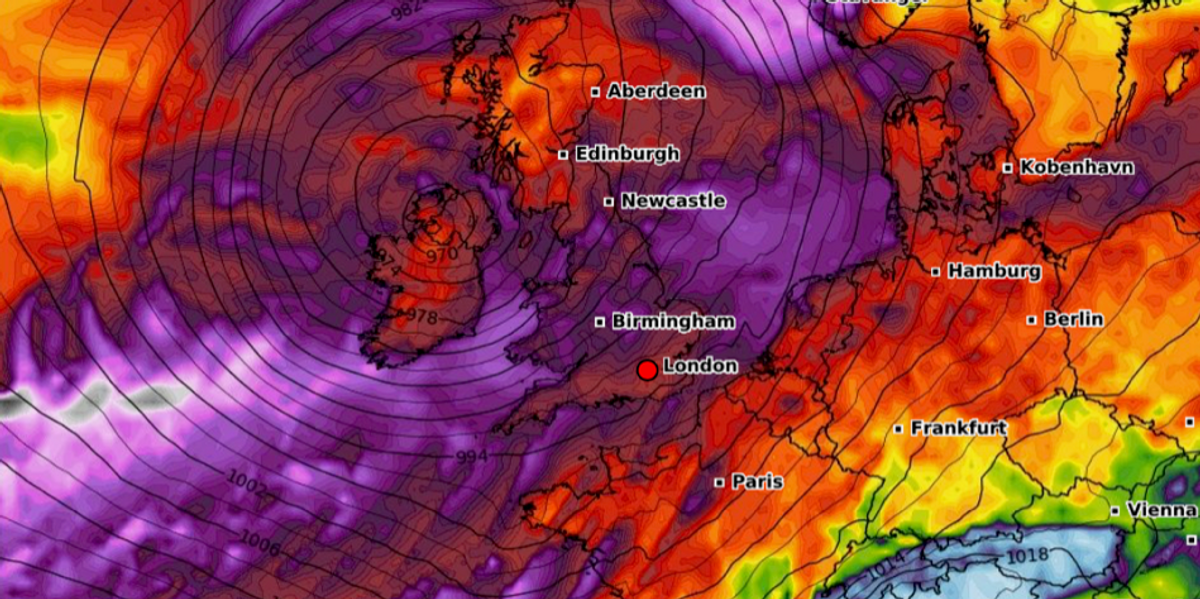
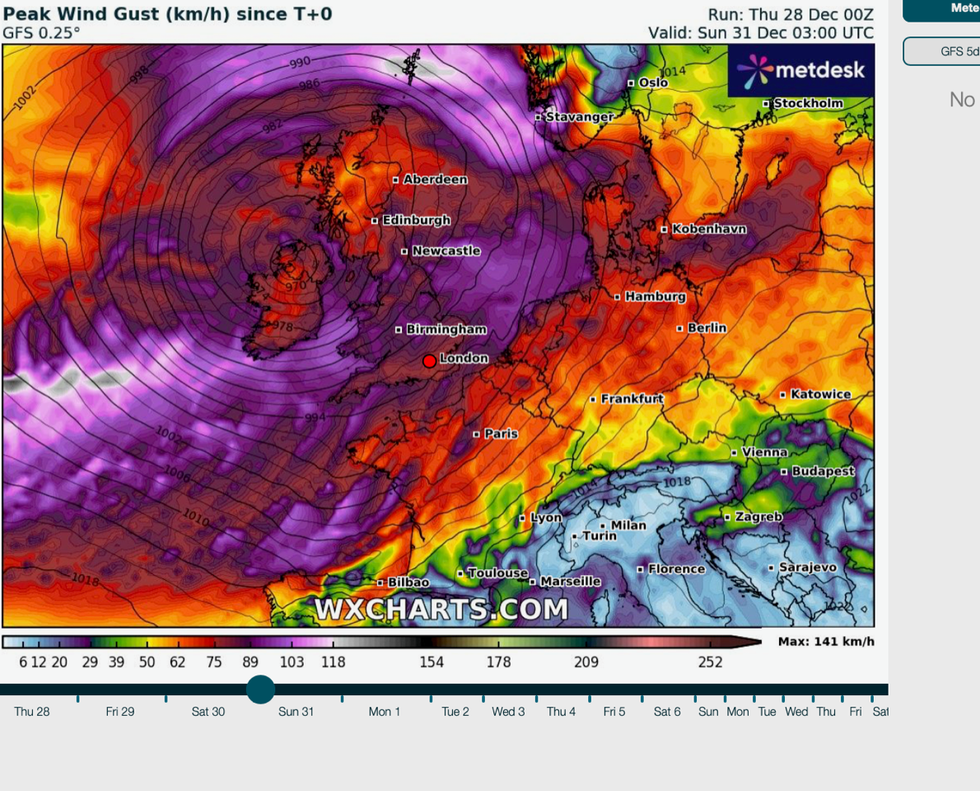
Storm Henk – the eighth storm of the season– threatens to smash Britain this weekend as New Year is threatened by nationwide gales, rain and up to eight inches of snow.
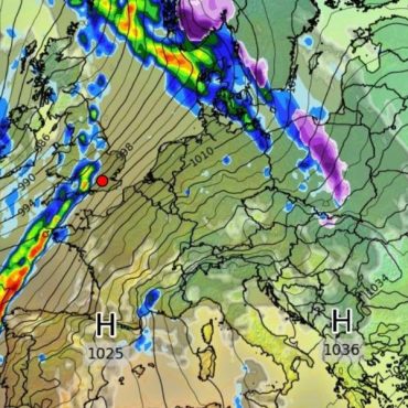
The entire country is on alert for three days of weather hell as the gates to the Atlantic swing open to a barrage of cyclonic low-pressure systems.
A large storm system due to smash into Britain tomorrow is likely to be named ‘Storm Henk’ by Met Eireann, according to the UK Met Office.
Volatile weather will maul the UK through the end of the year and into the start of 2024.

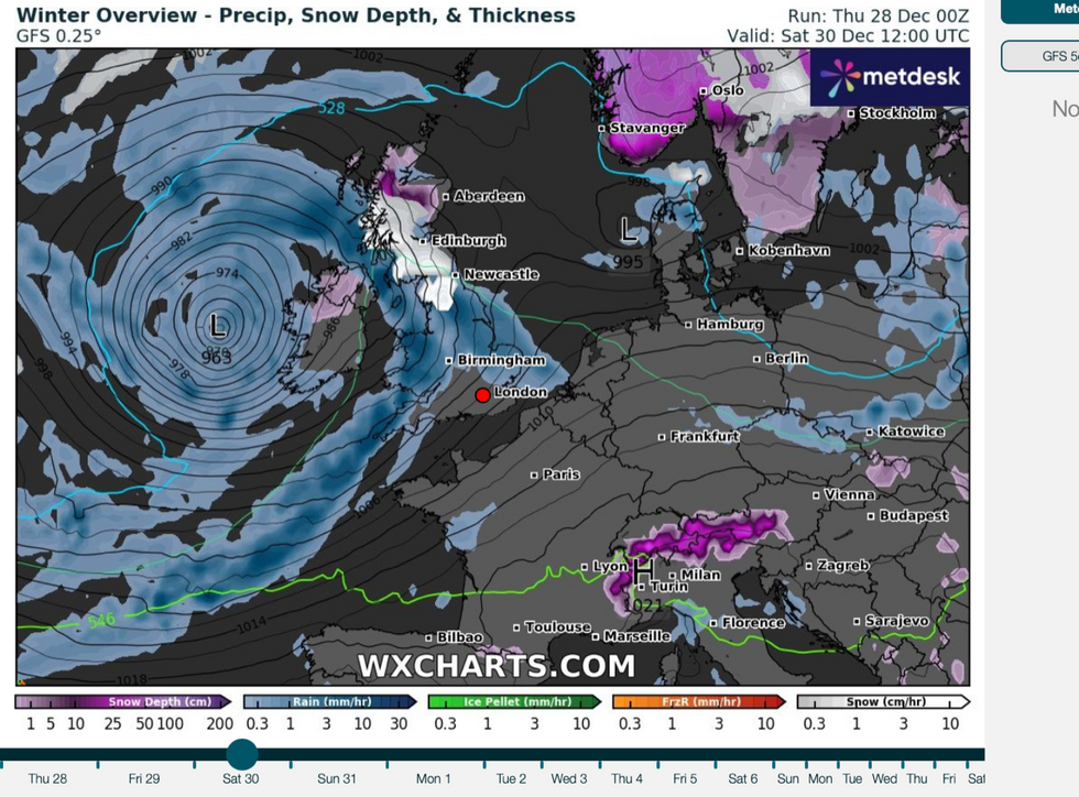
UK snow forecast: Bringing rain and snow to the UK
WX Charts
Met Office meteorologist Alex Burkill said: “The weather looks like it will be unsettled with further strong winds and heavy rain as we go through the last weekend of 2023.
“A deep area of low pressure is set to push its way in from the west, this low could be named Storm Henk by the Irish Met Service as it could be across the republic of Ireland where we see the strongest winds.
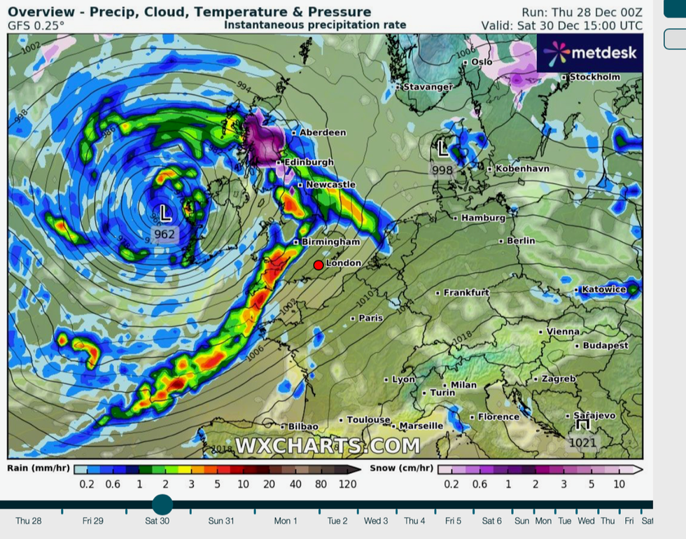
“Nonetheless, Saturday is going to turn wet and windy across the UK, a band of intense rain is going to push its way east and north-eastwards as we go through the day bringing the risk of gales or severe gales in exposed spots.”
WATCH: Met Office weather forecast
Regions hit by Storm Gerrit will be back in the firing line with ‘significant snow’ forecast in Scotland.
Up to eight inches could bury hilly regions, Mr Burkill said, although a winter blanket could also settle to lower ground.
Holidaymakers are warned to take extra care and prepare for disruption as severe weather continues to hammer the UK.

Storm Henk will bring heavy rain across the UK
WX Charts
The foul forecast comes as Britain reels from Storm Gerrit which hit at the start of the week unleashing heavy snow, torrential rain and wind.
The Met Office confirmed an unusually powerful ‘supercell’ thunderstorm in Greater Manchester had whipped up a tornado strong enough to rip the roof off a building.
Supercell thunderstorms form when a region of spiralling ‘wind shear’ is picked up into the updraft of a strong storm to create a churning whirlwind.
Volatile weather is forecast to persist through the start of 2024, with the risk of snow to spread southwards.

The foul forecast comes as Britain reels from Storm Gerrit
WX Charts
Jim Dale, social commentator and meteorologist for British Weather Services, said: “The jet stream is going to be drawing in more unsettled weather patterns in through the rest of the week, and if the Polar front sinks southwards, then there could be more of the wintry stuff coming with it, but this is something we are watching.
“Between now and New Year, we will see more low pressure coming in off the Atlantic, bringing a generally unsettled picture.”





Post comments (0)